Catalog Archive
Auction 145, Lot 473

"Royaume de Danemarck: Premiere Carte, Danemarck, Norwege et Islande", Chanlaire & Mentelle

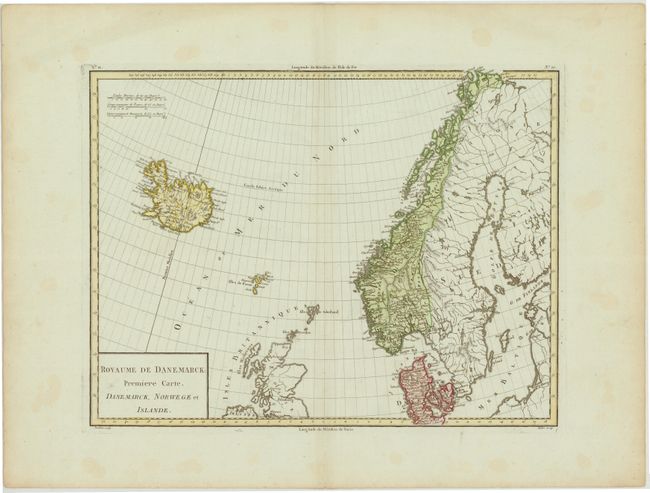
Subject: Scandinavia

Period: 1797 (circa)

Publication:

Color: Hand Color

Size:
16.8 x 12.7 inches
42.7 x 32.3 cm
Download High Resolution Image
(or just click on image to launch the Zoom viewer)

This map depicts Scandinavia, but place names are primarily confined to Norway, Denmark, and Iceland. The map extends to include Scotland and the Faroe Islands. Regions, major cities, mountains, and various water features are identified. Engraved by Tardieu.

References:

Condition: A

A nice impression on watermarked paper with a few small, scattered stains confined to blank margins.

Estimate: $110 - $140

Unsold

Closed on 6/12/2013

Archived