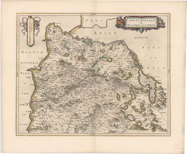
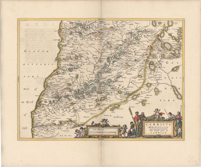
Subject: Southern Scotland
Period: 1654 (published)
Publication: Theatrum Orbis Terrarum sive Atlas Novus
Color: Hand Color
This pair of finely engraved maps depict the historic region of Carrick, now part of South Ayrshire. The maps, based on the work of Timothy Pont, famous surveyor of Scotland in the late sixteenth century, include great detail of the rivers, cities, villages and castles. The city of Ayr appears at the top of the northern sheet. Each map features an elaborate title cartouche and scale of miles cartouche, illustrated with regional figures and putti. Latin text on verso of the southern sheet only.
A. Caricta Borealis vulgo the Northpart of Carrick (20.7 x 16.5"). Condition: Attractive color and wide margins with a hint of offsetting and a bit of printer's ink residue. (A)
B. Carricta Meridionalis / The South Part of Carrick (20.7 x 15.1"). Condition: Attractive color and wide margins with light offsetting and some show-through of text on verso. (B+)
References: Van der Krogt (Vol. II) 5825:2 & 5826.2.
Condition:
See description above.