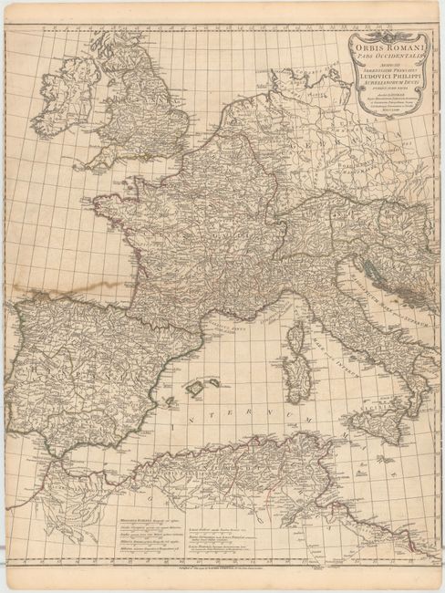
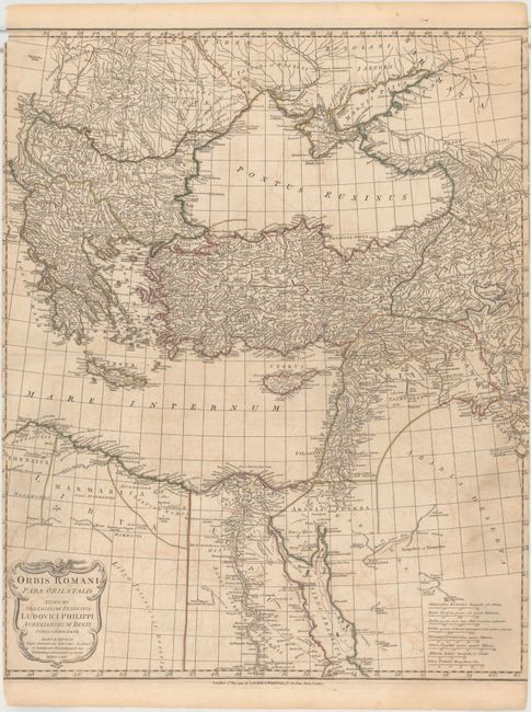
Subject: Europe
Period: 1794 (dated)
Publication:
Color: Hand Color
Size:
21.4 x 26.5 inches
54.4 x 67.3 cm
This attractive pair of maps, drawn by Jean Baptiste Bourguignon d'Anville, shows the extent of the Roman Empire in Europe. The maps cover the area from Ireland and England east to Greece, Turkey and the Arabian Penninsula and contain very good detail of towns, cities, rivers and topography. The title cartouches indicate the maps were drawn in 1763 and 1764 by d'Anville, and were published by Laurie & Whittle in 1794.
References:
Condition: C+
Original color on watermarked paper with offsetting, light toning, and several long centerfold separations that have been closed on verso with archival tape. Trimmed just inside of neatlines at right and left on both sheets, with loss of border. Remnants of hinge tape on verso.