Catalog Archive
Auction 145, Lot 34

"The World, on Mercator's Projection", Laurie, Richard Holmes
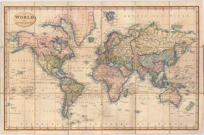
Subject: World

Period: 1822 (dated)

Publication:

Color: Hand Color

Size:
18.6 x 11.8 inches
47.2 x 30 cm
Download High Resolution Image
(or just click on image to launch the Zoom viewer)

This attractive world map on Mercator's projection is centered on western Europe, and excludes both polar regions. Oregon Territory is shown as a British possession and Australia is divided between New Holland and New South Wales. Africa shows only three political delineations including Morocco, Egypt and the Congo. Folds into gray paper boards.

References:

Condition: B+

Dissected and backed with linen with some light toning and a few faint ink notations around the compass. Covers show light wear and staining.

Estimate: $180 - $220

Sold for: $130

Closed on 6/12/2013

Archived