Catalog Archive
Auction 145, Lot 300

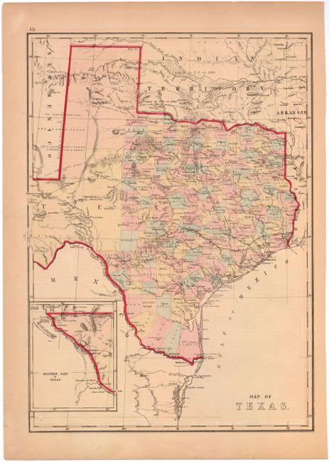
"Map of Texas", Williams, J. David
Subject: Texas

Period: 1869 (circa)

Publication:

Color: Hand Color

Size:
12.2 x 17.1 inches
31 x 43.4 cm
Download High Resolution Image
(or just click on image to launch the Zoom viewer)

This is an interesting map of Texas with superb detail of trails, ponds, springs, forts, and railroads. It shows county development and is filled with information on the region's resources (gypsum, salt, arable land, timber, sand, course grass, and forests labeled Mesquite Openings). The "Western Part of Texas" is shown in an inset on the same scale as the main map. Published by Hardesty & Co., in an Ohio county atlas as the verso contains two farm views in Henry County Ohio.

References:

Condition: B+

Light overall toning and minor soiling.

Estimate: $220 - $275

Sold for: $160

Closed on 6/12/2013

Archived