Subject: North America
Period: 1890 (circa)
Publication:
Color: Hand Color
Size:
16.5 x 11.5 inches
41.9 x 29.2 cm
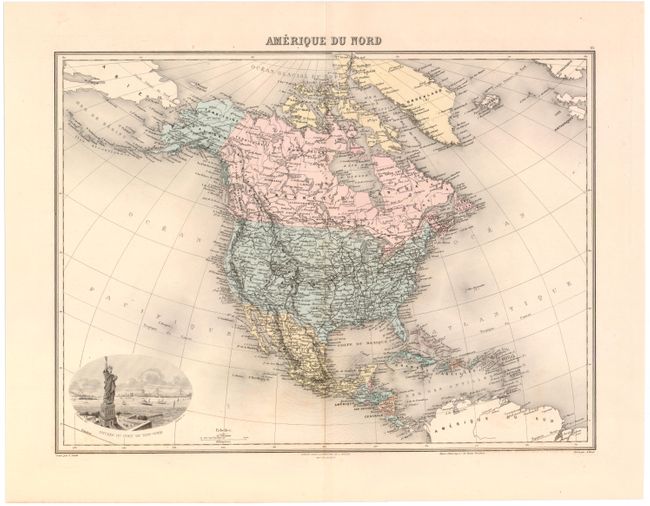
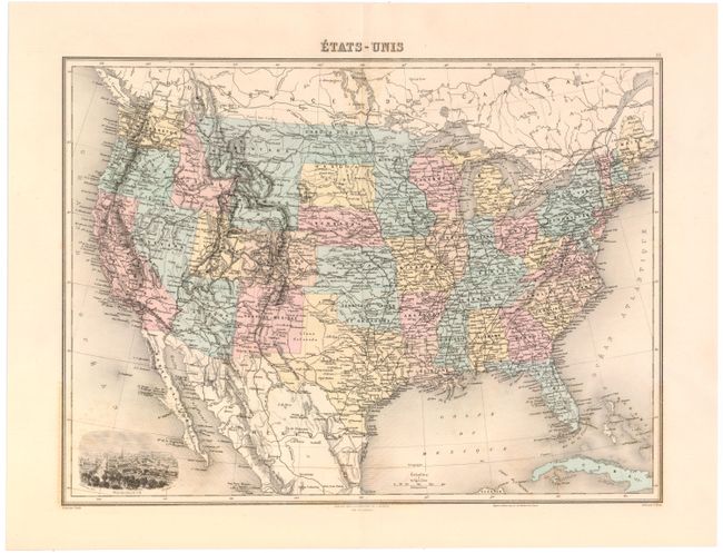
These two maps are from one of the last decorative atlases of the 19th century.
A. Amerique Du Nord. This finely engraved map is filled with information throughout including Alaska Territory and the Caribbean to the Windward Islands and Trinidad. There is good detail of the railroad system, shown in bold black with a vignette of the port of New York featuring the newly erected Statue of Liberty at bottom.
B. Etats-Unis. This view of the United States reflects today's borders, with the exception of Yellowstone National park which has its own boundaries and is labeled simply National Park. Oklahoma is Indian Territory with Public Lands in the panhandle. There is good political, topographic and watershed detail throughout with a vignette of the city of Washington at bottom.
References:
Condition: B+
Light offsetting and a few minor spots in the image.