Subject: Northern Africa and Southern Africa
Period: 1817 (published)
Publication: New General Atlas
Color: Hand Color
Size:
20.1 x 23.1 inches
51.1 x 58.7 cm
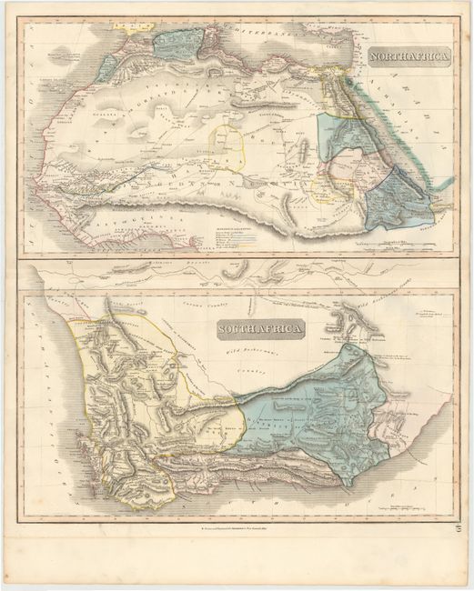
Two maps on one sheet detailing northern and southern Africa. The top map covers north Africa's Mediterranean coast and extends to include all of the Red Sea in the east and the Gulf of Guinea in the west. The map shows the areas of Morocco, Algeria, Libya, and Egypt, as well as the Sahara and Libyan deserts and the Mountains of the Moon. The bottom map depicts the southern tip of Africa divided into the districts of Stellenbosch, Zwellingdam, and Graaf Reynet. Both maps are filled with interesting details indicating the locations of caravan routes, cannibal tribes, cave paintings, "good water," and historical events.
References:
Condition: B+
Original color with a few unobtrusive, scattered spots, faint offsetting, and a crease in top blank margin.