Subject: Northern China
Period: 1796 (dated)
Publication: An Authentic Account of an Embassy from the King of Great Britain…
Color: Black & White
Size:
13.2 x 17.3 inches
33.5 x 43.9 cm
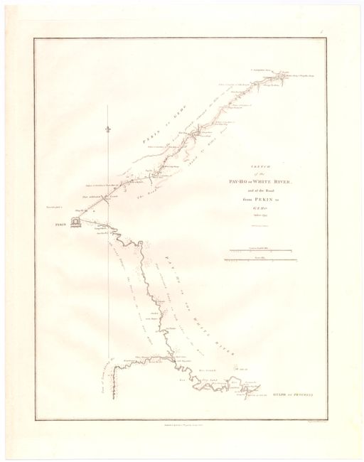
This large chart was part of an account of George Macartney's travels to China. Macartney was Britain's first envoy to China, and was tasked with convincing Emperor Qianlong to ease restrictions on trade between Great Britain and China by allowing the British to have a permanent embassy in the country.
The chart shows the course of the Hai River as it flows from Peking (Beijing) to its mouth in the Gulf of Petcheli, now the Bohai Gulf. Many notations describe the land around the river, indicating areas of "cultivated land," "rice grounds," "salt magazines," and "cut timber." The city of Peking is drawn as a fortified block, and the top half of the chart depicts the road from Peking to Geho, labeling important towns and palaces along the way. This rare chart includes a compass rose with fleur-de-lys pointer and is drawn from information supplied by John Barrow, who was the private secretary to Lord Macartney. He was later Secretary to the Admiralty and was a vice-president and founding member of the Royal Geographical Society. Published in London by George Nicol and engraved by B. Baker.
References: Shirley (BL Atlases) G.BARR-1a #8.
Condition: A
A nice clean sheet.