Catalog Archive
Auction 144, Lot 217

"Duodecim Tribus Israelis, sive Terra Sancta", Bonne, Rigobert
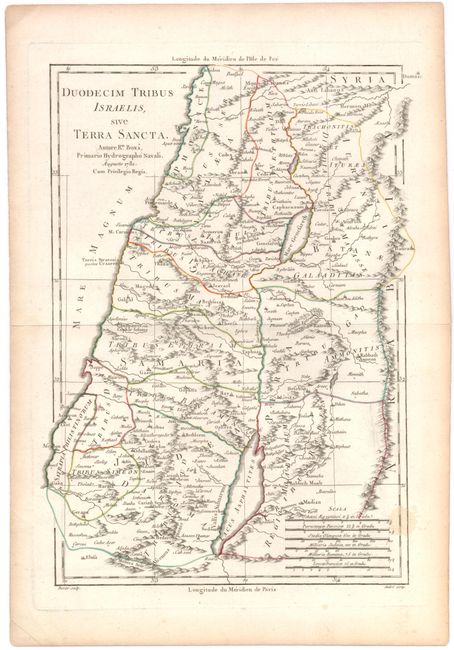
Subject: Holy Land

Period: 1781 (dated)

Publication: Recueil des Cartes sur la Geographe Ancienne

Color: Hand Color

Size:
8.5 x 12.5 inches
21.6 x 31.8 cm
Download High Resolution Image
(or just click on image to launch the Zoom viewer)

A fine map of Palestine depicting the territories of the 12 Tribes of Israel and including portions of Syria, Jordan, and Lebanon. The map covers the Mediterranean coast and locates the Dead Sea and the Sea of Galilee, along with many cities, towns, lakes, rivers, and mountains. The map was published in Recueil des Cartes Sur La Geographe Ancienne and engraved under the direction of Rigobert Bonne (1727-1795), the Royal Hydrographer and Director of the Depot de la Marine.

References:

Condition: B+

Watermarked paper with a stain in the bottom right corner of map and some marginal soiling.

Estimate: $55 - $75

Sold for: $40

Closed on 4/3/2013

Archived