Subject: Atlantic Ocean
Period: 1743 (circa)
Publication: The British Monarchy…
Color: Hand Color
Size:
11.8 x 10.3 inches
30 x 26.2 cm
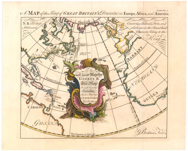
This handsome map drawn on a circular projection shows Great Britain's empirical reaches in the middle of the 18th century. A note below the title explains that place names "in the Round-hand Character, belong to the King." In North America, the eastern seaboard from Newfoundland to Georgia are marked as British possessions, in addition to several locations along Hudson's Bay (Port Nelson, Fort Louis and Fort Rupert). Numerous islands in the Caribbean are also marked, as well as Guiana in South America and Negroland in Africa. The dominating feature of the map, however, is a large ornamental cartouche containing a dedication to King George II, written in several different elaborate styles of script, for which Bickham was famous. George Bickham (1684-1758) was an engraver and calligrapher, and the founder of a family of engravers named Bickham who continued to publish maps until the end of the 18th century.
References: Shirley (BL Atlases) T.BICK-1a.
Condition: B
A fine impression, issued folding on watermarked paper with light toning and offsetting. A few short fold separations and a tear that enters 3.25" into map at bottom left have all been archivally repaired. This map presents itself very well.