Subject: Atlases
Period: 1861 (published)
Publication:
Color: Hand Color
Size:
4.3 x 6.7 inches
10.9 x 17 cm
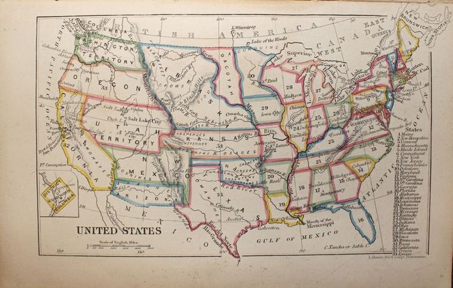
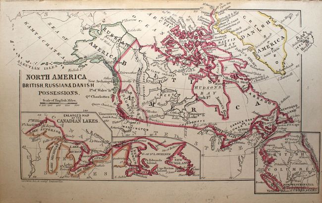
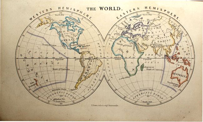
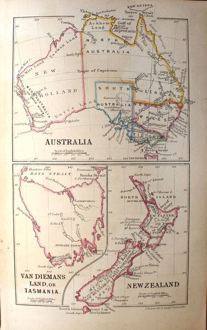
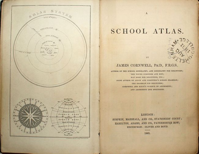
This charming miniature atlas by James Cornwell contains 28 maps, including two double-page maps of England/Wales and Scotland. There are separate maps of the world and continents, as well as 12 regional/country maps in Europe, 5 regional maps in Asia, 2 regional maps in Africa, and maps of the United States, Central America, Oceania, and Australia. The map of the United States depicts large Washington, Oregon, Utah, Nebraska, Dacotah and Kansas territories. Nebraska and Kansas extend west to the Rocky Mountains. New Mexico and Arizona are divided along the 34th parallel, reflecting the Confederates' claim during the Civil War. The map of North America shows Alaska as Russian America and includes insets of the Great Lakes, the Gulf of St. Lawrence and British Columbia. The atlas also features an engraving of the solar system as a frontispiece, and a table of 1000 locations around the world with the longitude and latitude for each. Numerous advertisements fill the endpapers. 16mo, hardbound in green pebbled cloth with a paper label on front cover with engraved title.
References:
Condition: B
The maps are in good to very good condition with original hand color, light soiling and toning. The binding is a little loose, and the covers show moderate wear.