Subject: Atlases
Period: 1757 (circa)
Publication:
Color: Hand Color
Size:
18 x 22.5 inches
45.7 x 57.2 cm
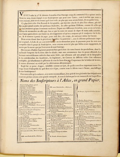
A nice example of Gilles and Didier Robert de Vaugondy's great atlas, with 97 (of 108) double-page maps. Gilles' and Didier's goal with the Atlas Universel was to create a work that was "commode, complet, uniforme, et suivi" (easy to handle, complete, uniform and consistent). Their desire for the atlas to be uniform and consistent, both in style and scale, was a concept introduced by one of their relatives, Nicolas Sanson. Atlas Universel was printed and published by Antoine Boudet, who also owned the plates. Rather than risk capital on such a big endeavor, Boudet decided to offer the atlas by subscription. The atlas includes a list of the subscribers, listed in the chronological order in which they were enrolled. Most of the subscribers were booksellers ordering multiple copies, although a number of geographers, royalty, lawyers, and government workers also subscribed. Subscriptions cost between 96-120 livres.
The majority of the maps were engraved by the family Delahaye, who also engraved maps for Gilles Robert's Atlas Portatif Universel et Militaire. The Vaugondys provided manuscript maps to the Delahaye workshop, where the Delahayes and their assistants engraved the copper plates. Once a plate was completed, it was brought to the Vaugondy's house for a proof to be pulled, at which point corrections would be noted and the plate would be sent back to the Delahayes for rework. Once a plate was satisfactorily completed, the Vaugondys would sign a note to be brought to Boudet, who would pay the Delahayes 220 livres per map.
The sources for many of the maps in the atlas were Sanson and Delisle, but the Vaugondys also used more up-to-date sources from the 1740s. The Vaugondys attempted to find the most accurate, up-to-date information possible, and succeeded in using maps from the Depot de la Marine as well as geographers of different countries. In addition to presenting accurate information, the Vaugondys also paid great attention to incorporating beauty and artistry in their atlas. Despite being designed and engraved by several different engravers, the cartouches are consistent throughout the atlas, with simple, yet elegant lettering framed by flowers, swags, and symbolic elements from the place being mapped. Most of the cartouches are engraved and signed by Elizabeth and Marie Catherine Haussard, while the remaining cartouches were by Moreau, C. Cochin, P.F. Tardieu, and Gobin.
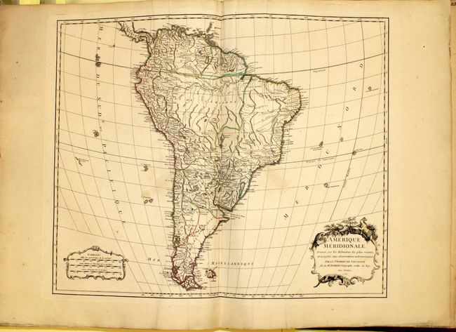
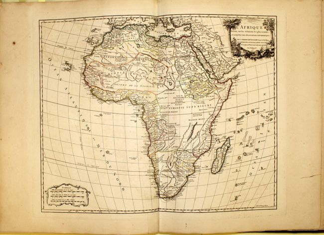
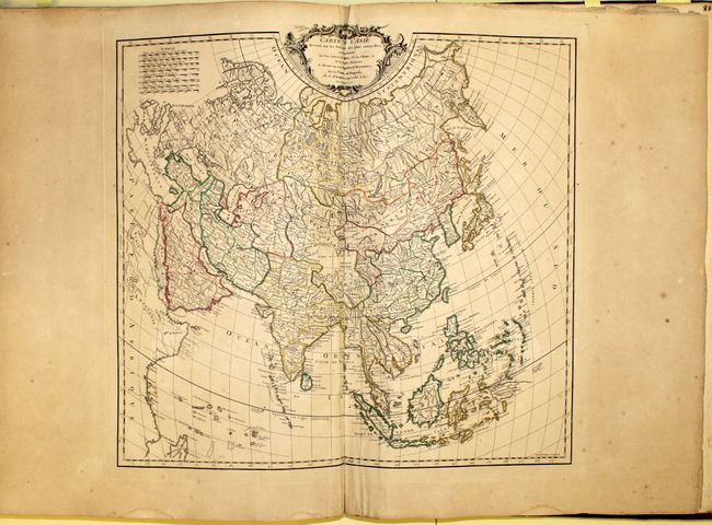
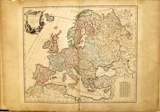
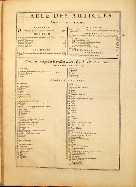
Included in the atlas are 9 maps of the ancient world, a modern double-hemisphere world map, 69 maps of Europe, 7 maps of Asia, 1 map of Africa, 6 maps of the Americas, and 4 maps of postal routes in Europe. There are many highly desired maps, including:
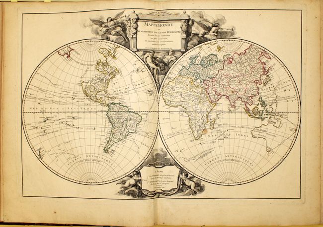
A. Mappemonde ou Description du Globe Terrestre shows the tracks of the voyages of Bouvet de Lozier (1738-9) in the Antarctic and of Anson (1740-43) across the Pacific, along with the Manila - Acapulco route of the Spanish galleons. It was Anson's capture of a richly laden galleon in 1743 that made his expedition so important in the annals of Pacific voyages. Australia is composed of a partial western coastline and a conjectural coastline connected to Tasmania, Terre du S. Esprit and New Guinea. Terre de Diemen appears both in Tasmania and on the northern coast. In North America there is a note in the Pacific Northwest that the area is not well known.
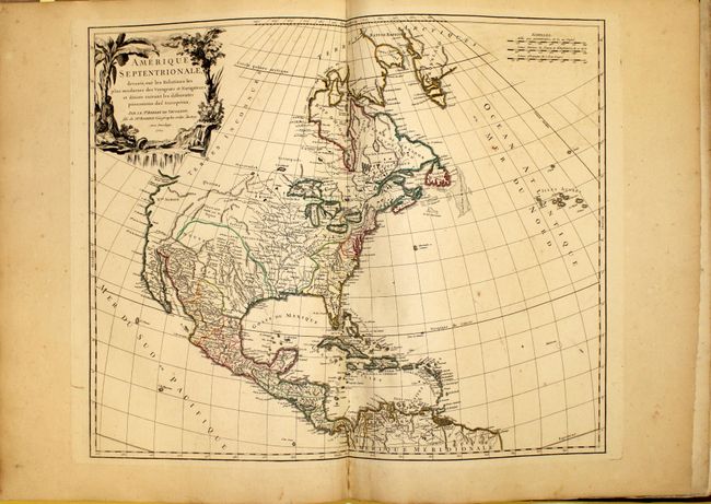
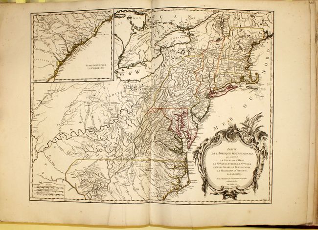
B. In Amerique Septentrionale, the colonial possessions are well defined and there are numerous Indian names throughout the Mississippi River valley and the Spanish possessions in New Mexico, while the rest of the western region is largely blank. In the Pacific Northwest, the Entrée decouvert par Martin d'Aquilar is shown alluding to a possible Northwest Passage.
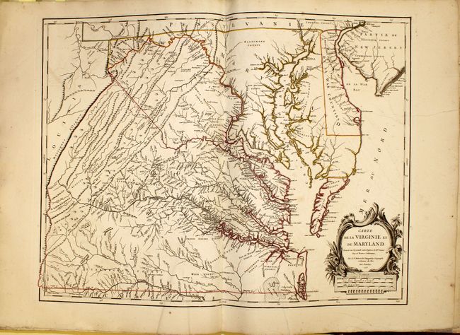
C. Carte de la Virginie et du Maryland is the first state of Didier Robert de Vaugondy's edition of the Fry-Jefferson map. It details the region from Cape May in New Jersey to the Currituck Inlet and inland with finely engraved details of the interior regions of Virginia, the ridges and valleys of the Appalachians, and the Chesapeake and Delaware Bays. The locations of native camps and wagon roads are noted as well. Delaware is labeled as De La War Counties.
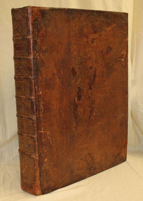
Original full leather covers with raised bands and gilt titling and decoration on spine. The endpapers and marbled pastedowns are modern. All maps have original stenciled number and short title on the verso. Missing title page, first eight pages of text, and 11 maps (ancient world, ancient France, ancient Italy, Sweden & Norway, southern Brabant, eastern Austria, Turkey in Europe, Southeast Asia, Egypt, Caribbean, and postal routes of France).
References: Pedley, pp. 51-68; Mickwitz & Miekkavaara #245.
Condition: B+
The maps are generally in very good condition with original outline color and light toning, light scattered foxing, and occasional offsetting. A few maps have repairs to centerfold, three maps have tears ranging from 1" to 8" in the image (Virginia & Maryland, South America and Prussia) with the Virginia map and South America map having been professionally repaired on verso with archival material, and the map of Spain & Portugal has a 1/2" hole in Africa. The binding is sound and the covers are heavily worn.