Subject: Western Africa
Period: 1727-1748 (circa)
Publication:
Color: Hand Color
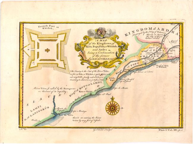
A. A Map of the Kingdoms of Koto, Popo, Fida, or Whidah, and Ardra Being a Continuation of the Former, by Jean Baptiste Bourguignon d'Anville, dated 1727 (9.0 x 5.8"). This map details the Slave Coast in western Africa, showing the kingdoms of Ladingkur, Koto, Popo, Ardra, and Fidah or Whidah. It includes locations of rivers, towns, and forts, as well as historical and practical information such as dangerous landing, a description of the landscape, and the origin of the river Volta's name. In the top left corner, there is an enlarged depiction of the French Fort at Whidah. Engraved by G. Child. Condition: A nice impression with light toning and soiling. (B+)
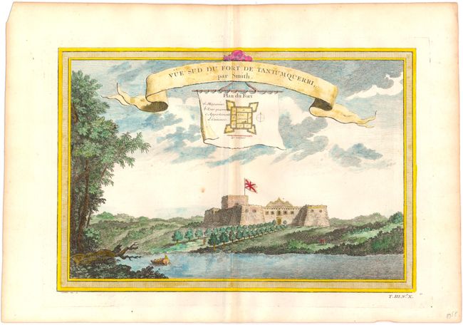
B. Vue Sud du Fort de Tantumquerri, par Smith, by Van Schley, circa 1748 (11.2 x 7.7"). View of a fort in the town of Tantum along the Gold Coast, with an inset showing the plan of the fort. Condition: A couple small spots. (B+)
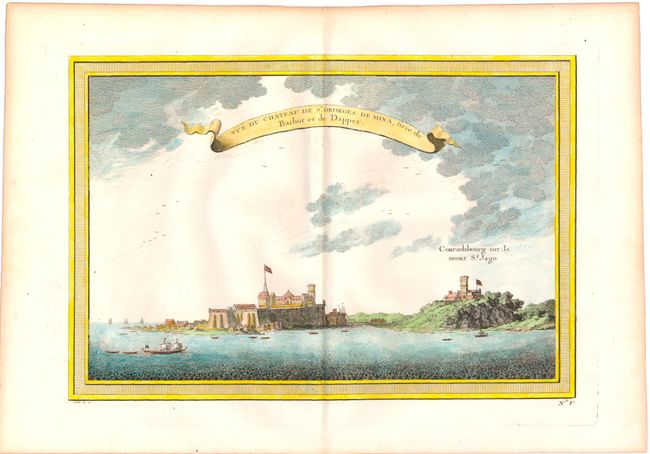
C. Vue du Chateau de St. Georges de Mina, Tiree de Barbot et de Dapper, by Van Schley, circa 1748 (11.2 x 7.7"). View of Elmina Castle, the first trading post built on the Gulf of Guinea. Fort Coenraadsburg, built to protect the castle, is seen to the right. Condition: (A)
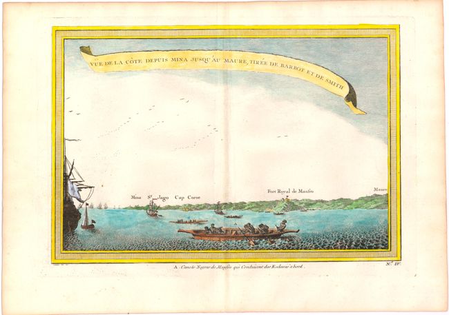
D. Vue de la Cote Depuis Mina Jusqu'au Maure, Tiree de Barbot et de Smith, by Van Schley, circa 1748 (11.2x7.7"). A view showing the Gold Coast from Mina to Maure, with a canoe in the foreground. Condition: A couple tiny, unobtrusive spots. (A)
References:
Condition:
See descriptions above.