Subject: St. Petersburg, Russia
Period: 1735 (circa)
Publication: Hedendaegsche Historie of Tegenwoordige Staet van alle Volkeren…
Color: Hand Color
Size:
7.6 x 6.3 inches
19.3 x 16 cm
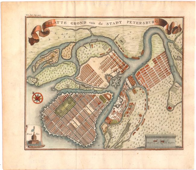
A nicely engraved bird's-eye plan of the city of St. Petersburg, centered on Petrogradsky Island and the Peter and Paul Fortress. The rectangular grid on Vasilyevsky Island shows Peter the Great's original intention of creating a network of intersecting canals and streets similar to Venice or Amsterdam. Kronstadt, the city's main seaport, is shown in a small scroll cartouche at bottom left. A banner-style title cartouche adorns the top of the plan. This map appeared in a Dutch edition of Thomas Salmon's multi-volume Modern History, which was published in up to 31 volumes starting in 1724, with several editions through 1782.
References:
Condition: B+
Issued folding with light toning, a few small, unobtrusive spots, and very faint offsetting.