Subject: Isle of Bute, Scotland
Period: 1654 (published)
Publication: Atlas Novus
Color: Hand Color
Size:
19.7 x 15.3 inches
50 x 38.9 cm
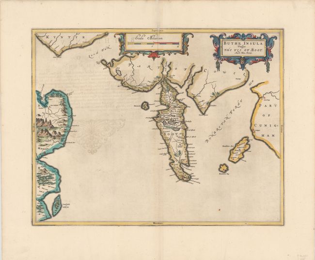
The Isle of Bute is shown at center, which is a small island at the end of the Firth of Clyde and west of Glasgow. The map illustrates the dramatic topography of the island that is bisected by the Highland Boundary Fault with rugged mountains in the north and lowlands in the south. At left is the northeast coast of the Island of Arran, with the port city of Brodwick (Brodick) shown. The map was drawn by Timothy Pont, a famous surveyor of Scotland. Latin text on verso.
Publication of Bleau’s atlas of Scotland (Atlas Novus, Volume V) in 1654 was a landmark publication in cartographic history. Most of the maps were based on the surveys of Timothy Pont, which had been done half a century earlier. The publication took over seven decades to bring to publication; delayed by wars, copyright restrictions, and only intermittent official support. The maps are scarce today due to the relatively short publication history of the atlas.
References:
Condition: A
Attractive color and wide margins with minor show-through of text on verso.