Catalog Archive
Auction 143, Lot 415

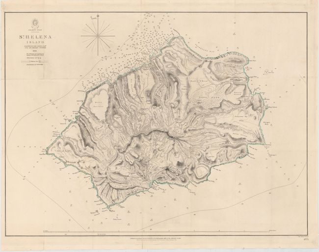
"St. Helena Island", British Admiralty

Subject: Saint Helena

Period: 1816 (dated)

Publication:

Color: Hand Color

Size:
23.8 x 17.6 inches
60.5 x 44.7 cm
Download High Resolution Image
(or just click on image to launch the Zoom viewer)

This is an uncommon topographical map of Saint Helena, a volcanic island in the South Atlantic Ocean. The rugged terrain of the island is depicted by hachure, and there is also good detail of towns, roads, rivers, and vegetation. Surrounding the island are hundreds of depth soundings, as well as safe anchorages and navigational hazards. The map was based on a survey by John Barnes with depth soundings by Captain F.W. Austin. Engraved by J. & C. Walker.

References:

Condition: A

Issued folding, now pressed, with very minor offsetting.

Estimate: $400 - $500

Sold for: $300

Closed on 2/13/2013

Archived