Subject: Caribbean
Period: 1827 (dated)
Publication:
Color: Hand Color
Size:
37.3 x 24.8 inches
94.7 x 63 cm
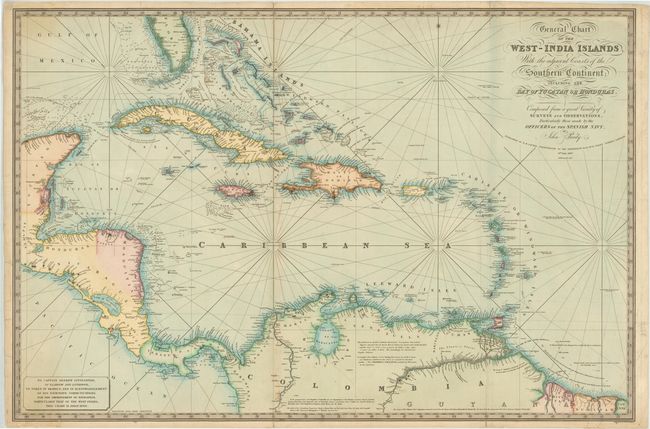
This large-scale chart depicts the southern tip of Florida, the Caribbean, Central America from Yucatan to Panama, and the northern coast of South America. There is great detail along the coasts, with numerous place names, soundings, safe anchorages, and navigational hazards. In South America, there is good inland detail of the Magdalena and Orinoco rivers and Lake Maracaibo. A small cartouche in the bottom left corner dedicates the chart to Captain Andrew Livingston. Engraved by W. R. Gardner and published by Richard Holmes Laurie.
References:
Condition: B+
There is light toning along folds, minor soiling, and a few creases. There are archival repairs to a few short fold separations and some short tears in blank margins that enter up to 1" into map. Overall very nice condition for a chart of this size.