Subject: Utah
Period: 1878 (dated)
Publication: HR Doc 73, 45th Cong., 2nd Sess.
Color: Printed Color
Size:
28.5 x 36 inches
72.4 x 91.4 cm
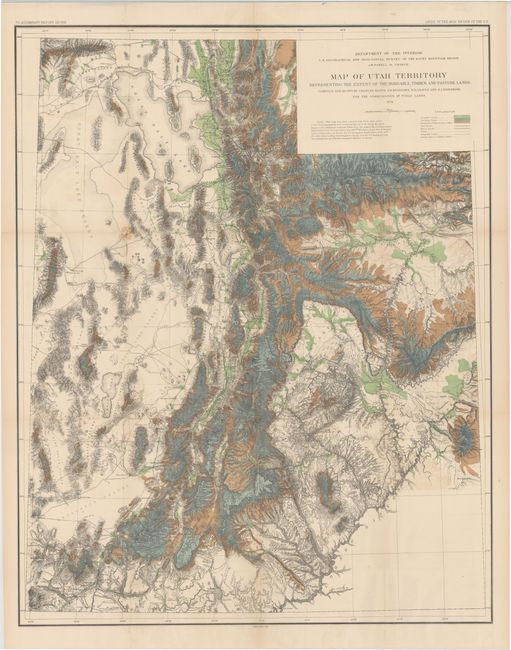
A colorful, graphic map that shows the populated regions of the territory; leaving off the arid portion west of the Great Salt Lake and the region south of the Colorado River. The map represents the extent of farm, lumber and pasture lands within the territory. It also details railroads, wagon roads, trails, telegraph lines, towns, forts, and county seats, plus topographic features and hydrography. Elevation information is given through fine hachure. The map was compiled from several earlier important surveys including those of Wheeler, King, and Hayden. This large, handsome map was published in John Wesley Powell's Report on the Lands of the Arid Region of the United States, with a more detailed account of the land of Utah.
References: Moffat #151; Wheat #1290.
Condition: B+
There are a number of short splits at fold intersections and some very faint offsetting in the image. There is one small brown stain to the southwest of the Great Salt Lake and a few additional fold separations confined to the blank margins.