Subject: Iowa
Period: 1852 (dated)
Publication:
Color: Hand Color
Size:
15 x 11.4 inches
38.1 x 29 cm
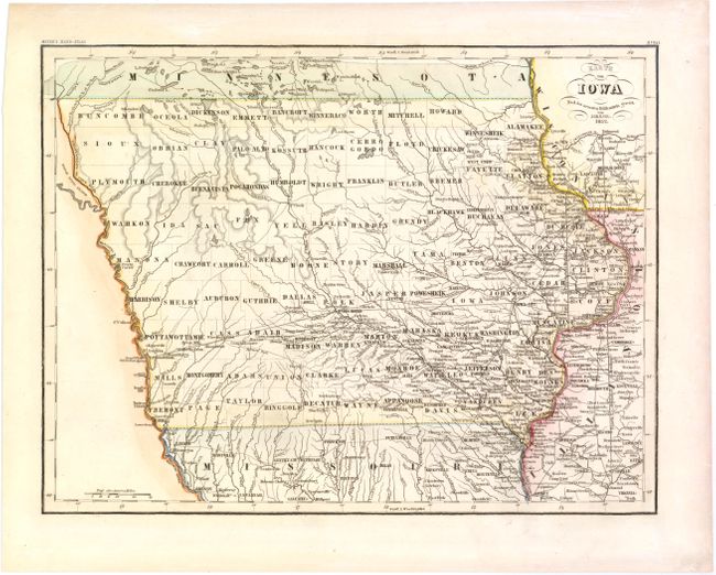
This is the German edition of Mitchell's map of Iowa from the New Universal Atlas, with a German title but English place names. This map was issued only six years after Iowa became a state and development is still confined to the eastern part of the state and along major waterways. The map shows good detail of the mid-19th century county development as well as the cities, towns, forts, topographical details and roads, including the Mormon Trail from Polk City to Wheeling's Ford. The capital is located at Iowa City and Des Moines is still Fort Des Moinis. Many of the western counties are newly organized, but contain no settlements.
References:
Condition: A
Light toning along sheet edges.