Subject: Western United States
Period: 1846 (dated)
Publication:
Color: Hand Color
Size:
19 x 21 inches
48.3 x 53.3 cm
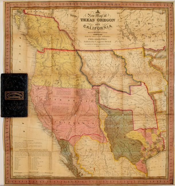
During the 1840s there was tremendous interest in understanding the landscape of the West given Texas' recent statehood. Mitchell capitalized on this interest by publishing one of the earliest maps to show the newly formed state. The map itself was based upon "the most recent published information extant," including the work of Nicollet, Wilkes and Fremont, and "the Congressional and other maps of Texas, the latest Maps of Mexico, &c." Mitchell's map was so esteemed that Lieutenant Emory wrote that it was one of only three maps he thought was worthwhile to carry along when he left Washington in June of 1846 to serve with the Army of the West (the others being Gregg's and Albert's).
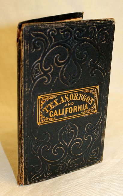
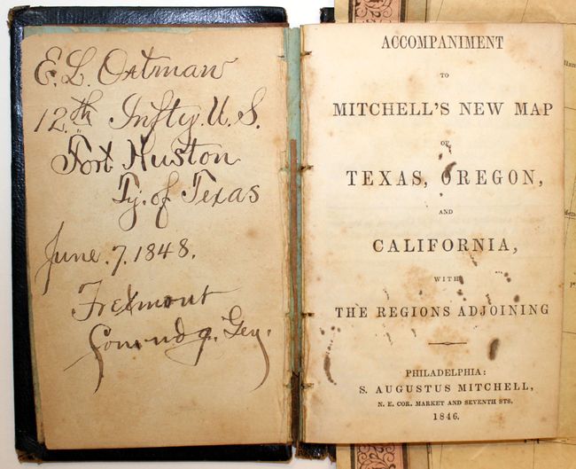
Cartographically, the stovepipe configuration shows the state's northern claim all the way to the 42nd parallel in present day Colorado, following Emory's map. The western border follows the Rio Grande. The map displays a large Oregon territory with the northern border well into British Colombia, reflecting United States interests. Large, early configurations of Missouri Territory, Indian Territory and Iowa are also depicted. The Gold Region of California is identified, along with the Oregon Route and the Caravan Route to Santa Fe. The map is filled with information on Indian tribes, rivers, topography and notations regarding the Great Basin. At bottom left is a distance table for places along the Emigrant Route. Folds into black leather boards with gilt title Texas, Oregon and California and includes a 46 pp. accompaniment describing the territories in detail.
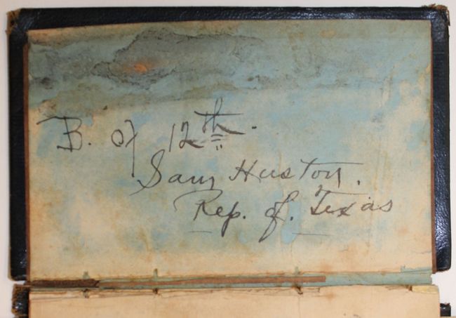
The map as been annotated to shown important changes in the boundaries with Canada and Mexico that occurred shortly after the map’s publication. The Columbia River is highlighted with a thin red line to show the British claims in Oregon prior to the Oregon Boundary Dispute resolution in 1846, and the final border is shown. The boundary with Mexico is shown along the Gila River per the Treaty of Guadalupe Hidalgo, 1848. The changes were done with complementary water colors, possibly by the publisher or distributor. The front endpaper bears the signature of the original owner, Enoch. A. Oatman, 12th Inftry. U.S. Fort Huston, Ty. of Texas June 7, 1848. There is also a note to Captain O.O. Howard in the back endpaper.
References: Wheat (TMW) #520; Wheat (Gold) #29; Phillips (America) p. 844.
Condition: B
Original color with a 1" edge tear where the map is attached to the back cover and a number of fold separations with a few resulting in minute loss. There are a few light scattered stains. Covers are worn and bumped with one of the endpapers in the accompaniment loose with previous owner's signature in manuscript.