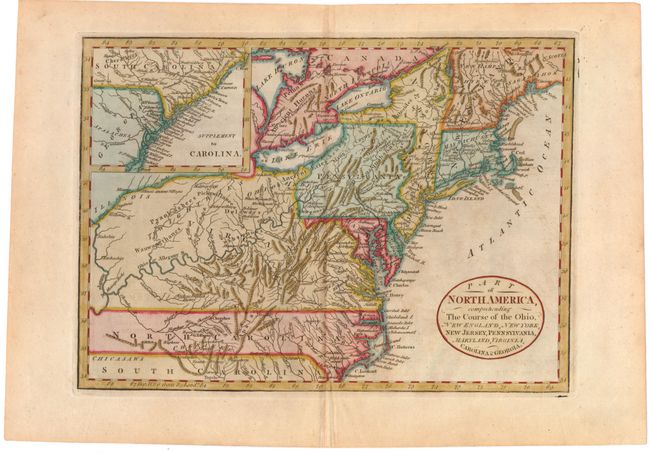
Subject: Eastern United States
Period: 1795 (published)
Publication: Guthrie's Universal Geography Improved
Color: Hand Color
Size:
11.6 x 8.3 inches
29.5 x 21.1 cm
A finely engraved map based on the larger map by Didier Robert de Vaugondy (McCorkle 755.37). The map is filled with detail of early settlements, Indian villages, and topography. The colonies extend to the Illinois and Mississippi Rivers, with North Carolina shown in an unusual, skinny configuration. The top left of the map is filed with the inset "Supplement to Carolina" which extends the map through South Carolina and part of Georgia on the same scale. With an oval title cartouche at lower right in the Atlantic. This is a later edition of the map with Cary's name and imprint removed. Earlier, it appeared in Seally's 1782 Dictionary, in Michael Adam's New Royal Geographical Magazine, and in his 1794 New Royal System of Universal Geography.
References: McCorkle #782.9.
Condition: B+
Attractive color with light, even toning, minor soiling and offsetting, and a short printer's crease at top.