Subject: United States
Period: 1860 (circa)
Publication:
Color: Hand Color
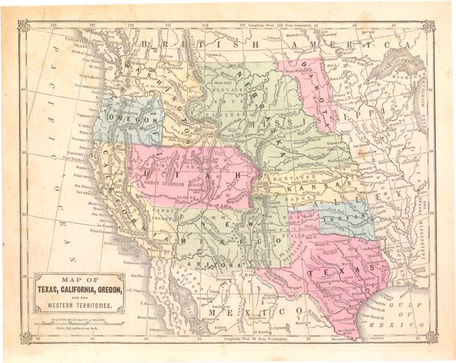
A. Map of Texas, California, Oregon, and the Western Territories, Anonymous (10.4 x 8.0"). This map shows an early western territorial configuration with a large Utah, New Mexico and Nebraska Territory. Condition: Minor foxing. (B+)
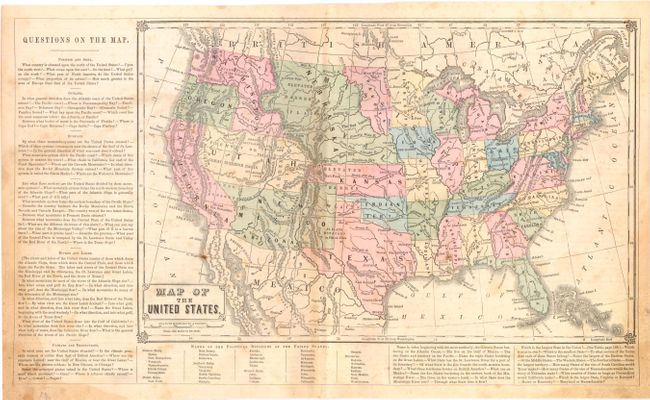
B. Map of the United States, Anonymous (17.2 x 10.2"). From a geography book with panels of text at left and bottom. Shows large Dakota, Nebraska, Kansas, Washington, Utah and New Mexico territories. Condition: Light soiling and scattered foxing. (B)
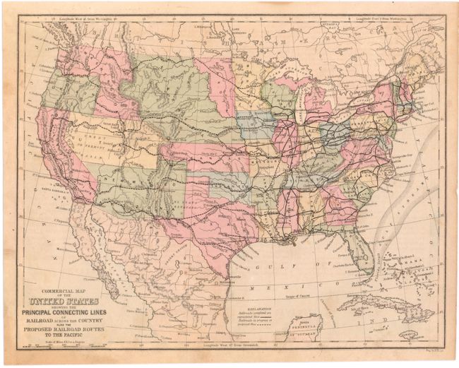
C. Commercial Map of the United States Showing the Principal Connecting Lines of Railroad Across the Country... (10.7 x 8.3"). Shows existing and proposed railroads, with a post-Gadsden purchase border to facilitate a proposed southern route. Engraved by Edward Yeager. Condition: Minor toning and light scattered foxing, with a small tear in the top blank margin closed on verso with archival tape. (B+)
References:
Condition:
See descriptions above.