Subject: Canada & United States
Period: 1853 (dated)
Publication: Outline of the Geology of the Globe…
Color: Hand Color
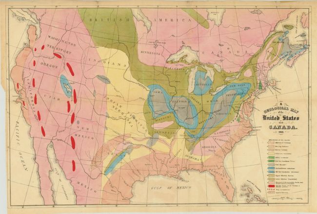
The first map (24.2 x 16") is Hitchcock's landmark map of 1853. Essentially, it is a compilation of Lyell’s map for the eastern portion combined with M. Boue’s Geological Map of the World for the western portion modified by the author’s generalizations derived from the relations of geography to geology, as argued in the report. In this respect, he freely admits that such generalizations for the western US might be greatly erroneous. This map provides early detail of the geological formations. An explanatory key to the colors indicates fifteen geologic formations. Condition: Clean and bright with original color, a tiny binding tear at left that just passes the neatline and has been closed with archival tape, some very faint offsetting, and light soiling primarily along the edges of the sheet. (B+)
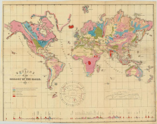
The second map (23 x 18") is drawn on Mercator's Projection. It shows the entire world with a separate hemisphere of the "Supposed Antarctic Continent" that locates Wilke's Land, South Victoria, Enderby Land and Cook's sighting of 1774. This map uses six different colors to locate as many geological formations. Along the bottom are the comparative heights of mountains and volcanoes aligned with the position on the map. Condition: Clean and bright with a 6.5" tear at right that has been closed on verso with archival tape. Minor soiling with the bottom margin trimmed beyond the neatline at left. (B)
References: Marcou & Marcou #4 & #41.
Condition:
See descriptions above.