Subject: Colonial North America & West Indies
Period: 1742 (dated)
Publication:
Color: Hand Color
Size:
19.3 x 20 inches
49 x 50.8 cm
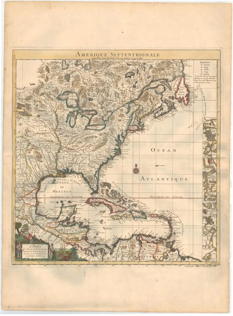
This is the handsome index sheet of the French version of Henry Popple's important map of the British Empire in North America. Popple's 20-sheet map is the finest and most detailed map of America of its time and covers the eastern part of North America between the Mississippi and Newfoundland and the adjoining regions of Central and South America and the Caribbean. The index sheet is a reduced version of the multi-sheet map and includes a panel containing 18 plans of prominent ports, harbors and islands including Cartagena, Charleston, Bermuda, New York City, and Boston. As tensions grew between the colonial powers, Popple's map became immensely influential throughout Europe and was copied by several cartographers. This French version exaggerates French territory at the expense of both England and Spain.
References: McCorkle #742.2.
Condition: A
Attractive color on watermarked paper with very wide margins at top and bottom, and a few tiny edge tears confined to blank margins that have been closed with archival tape.