Catalog Archive
Auction 143, Lot 100

"Fol. O. [America]", Scherer, Heinrich

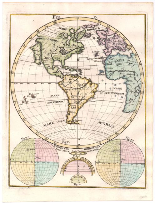
Subject: Western Hemisphere

Period: 1703 (circa)

Publication: Atlas Novus

Color: Hand Color

Size:
7.3 x 9.2 inches
18.5 x 23.4 cm
Download High Resolution Image
(or just click on image to launch the Zoom viewer)

This interesting chart was included in Scherer's geographical compendium that emphasized the Catholic hierarchy and spread of Jesuit missions throughout the world. The map focuses on the Americas but also shows a good part of Europe and Africa with the prime meridian placed just to the west of Bermuda. The large island of California is depicted with an unusual peninsula on its northwest coast. Only major geographical features and cities depicted. At the bottom are two global projections showing the distance between Constantinople and Goa.

References: McLaughlin #155.

Condition: A+

Estimate: $230 - $300

Sold for: $170

Closed on 2/13/2013

Archived