Subject: Atlases
Period: 1827 (circa)
Publication:
Color: Hand Color
Size:
11 x 14.5 inches
27.9 x 36.8 cm
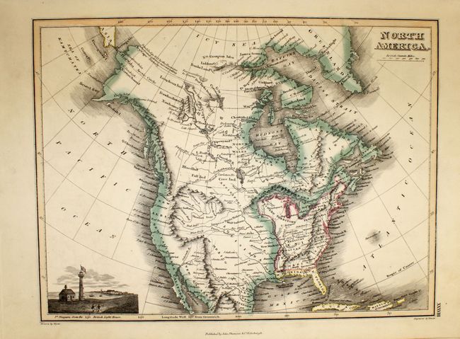
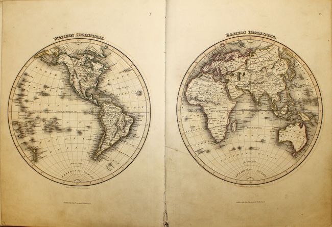
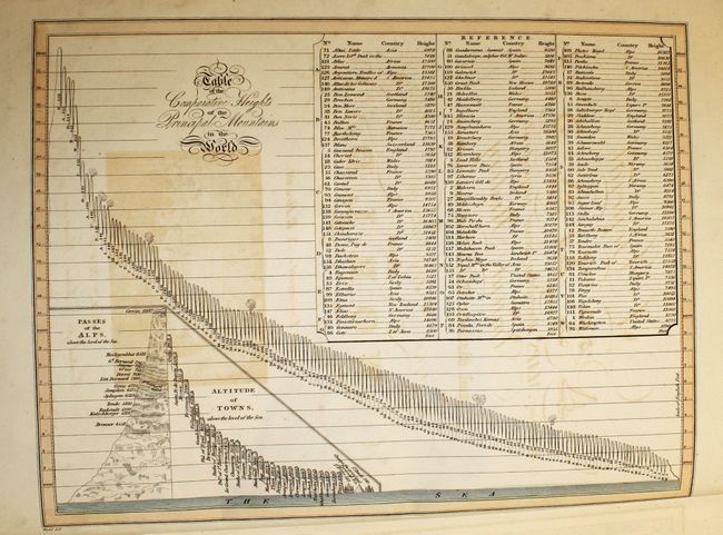
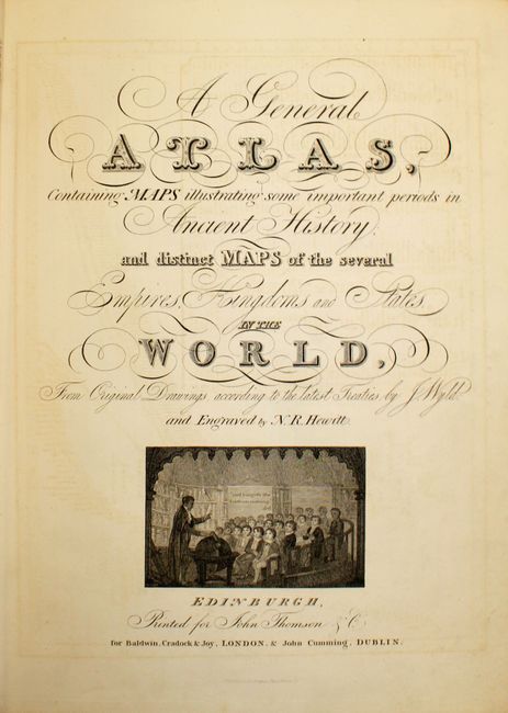
This complete atlas contains 44 maps (two of which are double-page) and two tables: Comparative Heights of the Principal Mountains and Comparative Lengths of the Principal Rivers. The atlas begins with three chapters on A Memoir of the History of Geography, A Chronology of the Voyages of Discovery, and An Analysis of Physical Geography, which include engravings of the dispersion of animals around the world and views of mountain ranges on each continents. The maps include four of the ancient world, a double-hemisphere world map and one on Mercator's projection, maps of the continents, eighteen maps of European countries, six maps of Asian countries, United States, West Indies, three maps of the South Pacific, and one map of the Arctic Circle. Each map (with the exception of the two world maps) features one or more vignettes illustrating a subject related to the map. The maps were drawn by Wyld and engraved by N.R. Hewitt and W.H. Lizars. Published by John Thomson in Edinburgh, to which the atlas is sometimes credited.
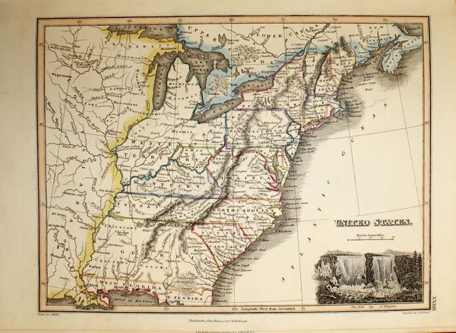
The map of the young United States (circa 1819) includes several important historical regions. One of the most unique and scarce features on early maps of the United States is the appearance of Franklinia. This ephemeral state appeared on only a small number of maps into the early part of the 19th century, this being a late example. Another interesting feature is the region labeled Indiana that takes up what is now West Virginia. This land was a major contention between the private Indiana Land Company and the State of Virginia in the latter part of the 18th century. Georgia extends from South Carolina to the Mississippi River. Several interesting place names include the Heckerton Settlement, many early forts, Indian villages, and the location of the winter camps for Lewis & Clark in 1803/04 and Lieut. Pike's two years later. The large Western Territory takes up present-day Michigan, Wisconsin, Illinois, Indiana and Ohio with the large Louisiana Territory further west.
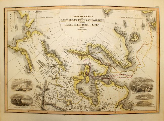
The map of the Arctic Regions (Discoveries of Capts. Ross, Parry & Franklin in the Arctic Regions) shows recent discoveries up to 1827. The discoveries and routes of Captains Ross, Parry and Franklin are depicted, and there are notes on MacKenzie's discoveries and the point reached by the HMS Blossom under Capt. Beechey. Alaska is named Russian Settlements, and the coastline is still quite conjectural. The map features five vignettes of coastal views, including Baffin Bay, Burnet's Inlet, Coppermine River, and the south side of Scoresby's Sound.
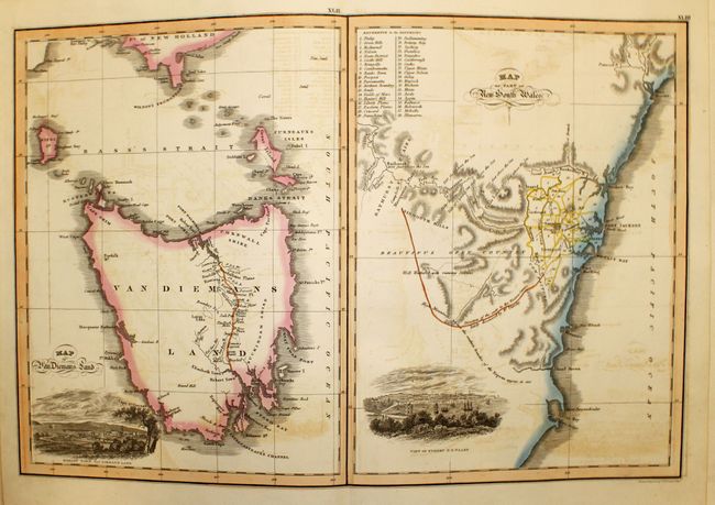
The two maps of Australia, on one sheet, show the extent of interior exploration. The Map of Van Diemens Land shows the new road linking Hobart and Launceston and includes an inset of Hobart Town. The map of New South Wales focuses on the region around Sydney, which is divided into 38 districts, and includes a view of Sydney.
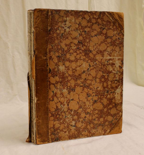
Folio. Marbled-paper covered boards with quarter leather spine and tips. The second half of the atlas is still attached to the back board, while the first half of the atlas (including the front cover) is completely disbound. Sold as a set of maps.
References:
Condition: B
Original color. The majority of the maps are clean and bright in near fine condition. About a dozen maps are in very good condition with light soiling and offsetting. Two maps are in good condition, with the map of England and Wales moderately toned and soiled, and the map of Asia torn in half and repaired with old paper on verso. The map of Europe is badly defective. The text is in very good condition. The binding and spine are perished. Both covers are worn and the front cover is completely detached.