Catalog Archive
Auction 142, Lot 705

"Karte von Neu Holland nach den Neuesten Entdeckungen Entworfen und Gezeichnet von Dr. Friedr. Ludwig Lindner Professor der Geographie",
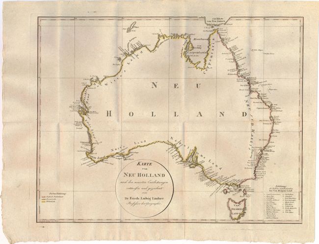
Subject: Australia

Period: 1815 (circa)

Publication: Der Funfte Welttheil Oder Australien

Color: Hand Color

Size:
16.8 x 13.1 inches
42.7 x 33.3 cm
Download High Resolution Image
(or just click on image to launch the Zoom viewer)

This early map of Australia shows the discoveries of the English, French and Dutch in different hand colors. Southeastern Australia and western Victoria are depicted as Napoleons Land. The inland is completely void of information, but there is good detail of the coastline. At lower right is a key locating 23 different locations in Van Diemens Land. Published in Friedrich Ludwig Lindner's Der funfte Welttheil oder Australien.

References: Perry & Prescott #1814.21.

Condition: B+

Issued folding on thick, watermarked paper with a few minor spots.

Estimate: $600 - $800

Sold for: $300

Closed on 11/28/2012

Archived