Catalog Archive
Auction 142, Lot 47

"[Lot of 2] Johnson's Globular World [and] Johnson's World on Mercators Projection", Johnson, A. J.
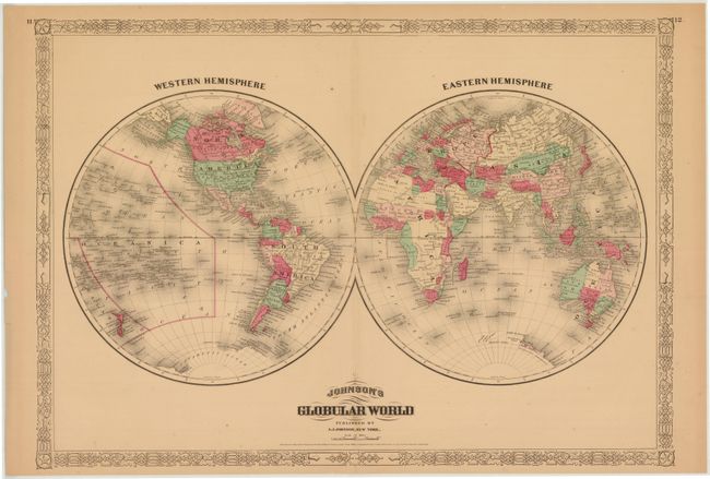
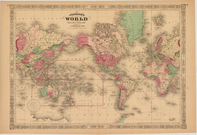
Subject: World

Period: 1865-67 (dated)

Publication: New Illustrated Family Atlas

Color: Hand Color

Size:
23.2 x 16.4 inches
58.9 x 41.7 cm
Download High Resolution Image
(or just click on image to launch the Zoom viewer)

Attractive pair of world maps from Johnson's New Illustrated Family Atlas. Each is very detailed, showing political boundaries and numerous place names. Surrounded by a decorative border with fancy titling.

A. Johnson's Globular World, dated 1867. Shows a very early understanding of the Antarctic coastline.

B. Johnson's World on Mercators Projection, dated 1865. Centered on North America, this map shows the tracks of Captain Cook and Captain Wilkes, as well as the Line of Atlantic Telegraph Cable between North America and Europe.

References:

Condition: B+

Lightly toned with a few minor spots and small centerfold separations at bottom that just pass the decorative border.

Estimate: $150 - $200

Sold for: $75

Closed on 11/28/2012

Archived