Subject: Panama, Central America
Period: 1900-25 (circa)
Publication:
Color:
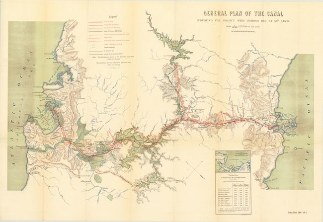
A. General Plan of the Canal Indicating the Project with Dividing Bed at 68ft. Level , by Julius Bien, from Sen. Doc. 188, 1st Sess., 56th Cong., circa 1900, printed color (32 x 19"). This map has beautiful color and precise engraving. Fine detail illustrates the proposed route of the Panama Canal and as far north as El Aguila on the Rio Chagres. Locates the villages of San Juan, Santa Barbara, Dos Bocas, El Vigia, Las Campanas, Alhajuela and Garun. Extensive legend identifies the line of the canal, completed and uncompleted diversions, Panama Rail Road and limits of the artificial lake. A small inset portrays a "General chart of the Isthmus of Panama Indicating the Position of the Canal" and a table lists the distance reduced via the canal to various ports including San Francisco, Honolulu, Valparaiso, Victoria (Canada) from the "official tables published by the French Government…January 29th, 1881." This uncommon map will be a fine addition to any Panama Canal collection. Condition: Fine. (A+)
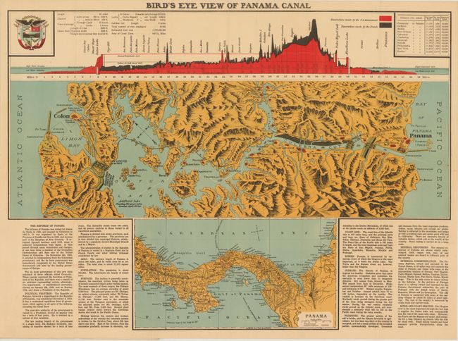
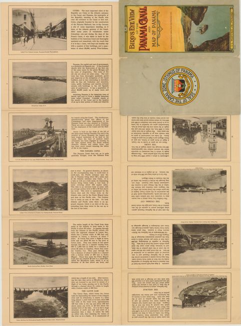
B. Bird’s Eye View of the Panama canal and Map of Panama, by I. L. Muduro Jr., circa 1922. printed color (23.5 x 17.5"). This rare pocket map was published in Panama. The full color Art Nouveau cover (4.5 x 9") features a chromozylograph of a freighter traversing the canal at the Culebra Cut. The back cover has the Seal of the Canal Zone Isthmus of Panama with the motto "The Land Divided the World United." The colorful folding map shows the canal in great detail and in partial birds-eye prospective. Above the map is a matching profile of the canal color coded to show the excavations of the French and the U.S. Below is a map of Panama which includes part of Costa Rica and Columbia. At upper left is a fine rendering of the handsome seal of Panama with the motto "Pro Mundi Beneficio." On the verso are ten photographs and text describing the canal and interesting places in Panama, including a fine image of the U.S.S. Tennessee moving through the Gatun Locks. The Tennessee was commissioned in 1921 and steamed through the canal in June of 1921 on its way to its home port of San Pedro, California. Condition: Paper covers are worn, but map is near fine. (A)
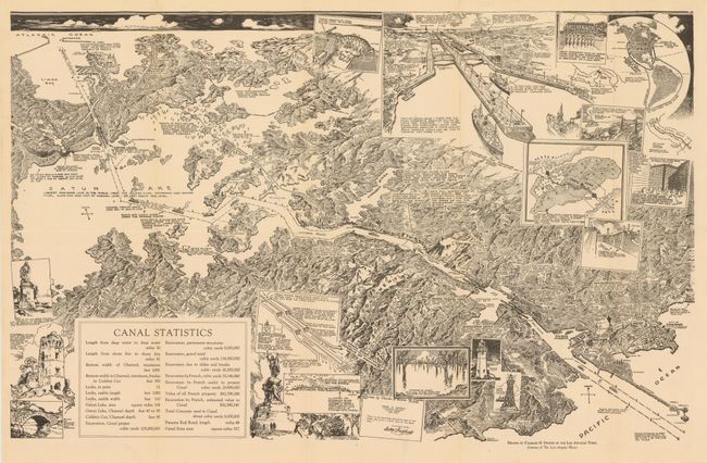
C. [Untitled - Bird's Eye View of the Panama Canal], by Charles H. Owens, dated 1925, black & white (24.5 x 15.8"). This is an untitled bird's eye view of the Canal. The map has numerous illustrations including one of the Gatun Locks. Condition: (A).
References:
Condition:
See descriptions above.