Subject: Charleston, South Carolina
Period: 1787 (published)
Publication: Histoire de la Revolution d'Amerique, par Rapport a la Caroline Meridionale
Color: Black & White
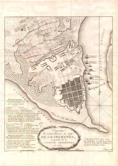
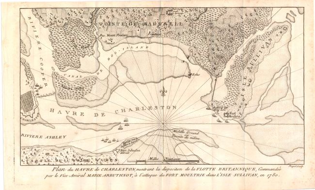
These two rare maps of the Siege of Charleston are from the French edition of Ramsey's The History of the Revolution of South Carolina. The Siege of Charleston was a major battle in the Revolutionary War and occurred in the later stages of the war as the British focused their efforts on the colonies to the south. After a six-week battle, the Americans surrendered the largest number of troops in the entire war. Ramsay was a resident of Charleston and is known for his accurate historical reporting. Originally engraved by Thomas Abernethie, a Scottish engraver in Charleston, these maps were re-engraved by Picquet for the French edition.
A. Esquisse des Operations du Siege de Charleston, Capitale de la Caroline Meridionale, (11.2 x 13.8"). This superbly detailed plan of Charleston depicts the position of the British ships and encampments surrounding Charleston. An extensive key details the forces and resources available at various locations.
B. Plan du Havre de Charleston, Montrant la Disposition de la Flotte Britannique..., (11.2 x 13.8"). This small, attractive engraving depicts Charleston Harbor and the surrounding area, including Fort Johnson, Fort Moultrie and the fortification at Charleston. Numerous ships are shown in the harbor, including the blockade along the Cooper River.
References: Nebenzahl (Biblio) #84 & #85.
Condition: A
Issued folding on watermarked paper with a few minor spots.