Subject: Alaska
Period: 1798 (dated)
Publication: Nuovo Atlante Geografico Universale
Color: Hand Color
Size:
19 x 13.7 inches
48.3 x 34.8 cm
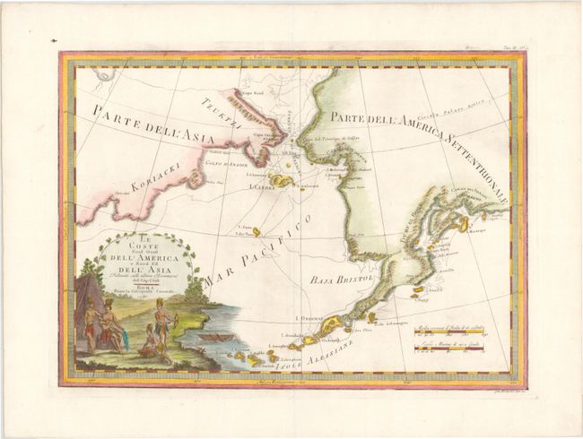
This map of Alaska, the Bering Strait, and Siberia shows the route of Captain Cook's third voyage from 1778-1779. Cook and his crew sailed to the Alaskan and Chukotskiy peninsulas and from there into the Bering Strait in search of a Northwest Passage. Cook reached 70° 41’ N before being forced back by the icy conditions. The expedition then turned south down the Siberian coast where it ended in Hawaii when Cook was killed in a dispute with the natives. This voyage provided the most accurate mapping at the time of the Alaskan coastline and the Aleutian Islands. The large decorative cartouche in the bottom left corner depicts four native American figures, including a woman feeding her child, a man gathering food, and another man preparing to hunt.
References:
Condition: A
A nice impression on watermarked paper with wide original margins. One spot of printer's ink along the edge of the plate mark at top left.