Catalog Archive
Auction 142, Lot 192

"Map Showing the Position of Chicago in Connection with the North West & the Principal Lines of Rail Roads, Canals, Navigable Streams and Lakes…",

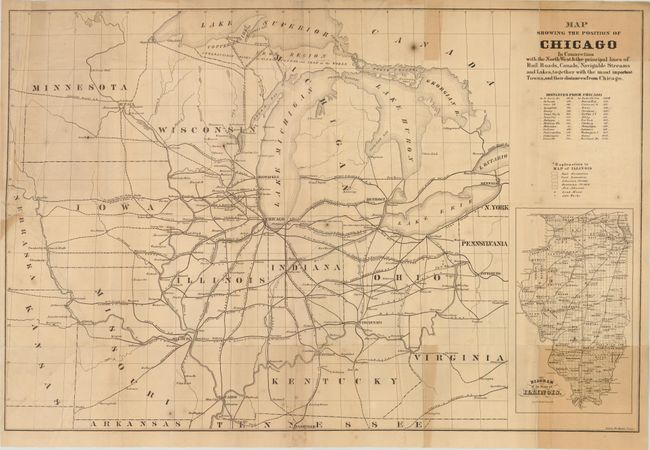
Subject: Central United States, Chicago

Period: 1855 (circa)

Publication:

Color: Black & White

Size:
24.9 x 16.7 inches
63.2 x 42.4 cm
Download High Resolution Image
(or just click on image to launch the Zoom viewer)

This very rare, pre-fire map of Chicago shows the extensive railroad network, establishing the city as the transportation hub of the Midwest. The upper peninsula of Michigan is noted as "inexhaustible mines of the finest copper and iron in the world." A key identifies coal formations, lead mines and salt works. At lower right is an inset of Illinois. There appears to be only one record of this map per WorldCat, which is housed in the Library of Congress. Engraved by Edward Mendel.

References:

Condition: B

Issued folding with a few small fold separations, some uneven toning at right, light offsetting, and minor creasing. There is a tear at left that extends 1.5" into the map image that has been repaired on verso with archival material.

Estimate: $200 - $250

Sold for: $110

Closed on 11/28/2012

Archived