Catalog Archive
Auction 142, Lot 159

"Geographically Correct Map, Showing Chicago, Al & St. Louis and Chicago, Kansas City and Denver Short Lines and Connections...", Railroad Companies, (Various)

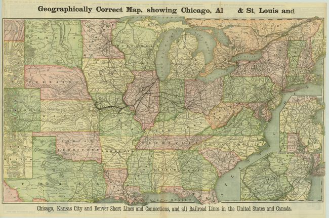
Subject: Eastern United States

Period: 1880 (circa)

Publication:

Color: Printed Color

Size:
34.8 x 22.5 inches
88.4 x 57.2 cm
Download High Resolution Image
(or just click on image to launch the Zoom viewer)

This scarce and detailed map shows the eastern two-thirds of the United States. Numerous railroads are depicted, with an emphasis on the route from Chicago to Alton and St. Louis. In addition to the railroads, the map shows cities, rivers, and mountains in hachure. Inset maps of Boston and New York/Philadelphia are at lower right, with the verso containing timetables and various advertisements. Curiously, the title is misspelled with Alton only showing as "Al."

References:

Condition: A

There are a few fold separations that are repaired with archival material on verso.

Estimate: $250 - $325

Sold for: $180

Closed on 11/28/2012

Archived