Subject: North America
Period: 1822-51 (circa)
Publication:
Color: Hand Color
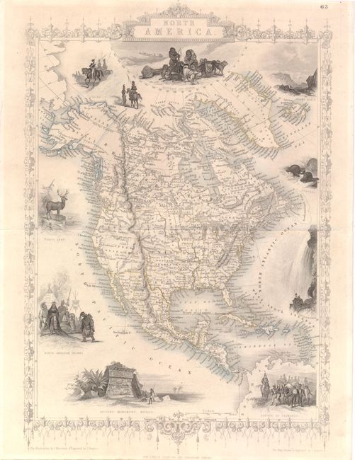
A. North America, by John Tallis, circa 1851, (9.5 x 13.5"). The vignettes surrounding this decorative map of North America were drawn by J. Marchant and engraved by J. Rogers. The map is filled with forts and locates many Indian tribes. Texas is shown in a curious configuration without a panhandle, Western Territory takes up much of present-day Kansas and Oklahoma, and New Mexico is shown as a tiny strip of land above Texas. The vignettes include an Ancient Monument in Mexico, Convoy of Diamonds, Falls of Niagara, Beavers, Elk, and North American Indians. Across the top are Russian Cossacks (representing the Russian Possessions in Alaska), an Eskimo dog sled and Mount Hekla, Iceland. The map was drawn and engraved by John Rapkin. Condition: Original outline color with light toning.
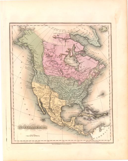
B. North America, by Fielding Lucas, circa 1822, (9.0 x 10.6"). In the area of the Great Salt Lake is L. Trinpanogos and a little south is either Utah Lake or maybe Sevier Lake "whose western Limits are Unknown." The Strait of Juan de Fuca is labeled as Supposed. The Great Basin region is here called Plains of Nuestra Senora and Luz. Locates many Indian tribes, forts and good detail of watershed. The correct shape of the Rocky Mountains is being approached here. A very nice example of this map that is rarely offered today. Condition: Original color with a few tiny spots.
References:
Condition: A
See descriptions above.