Subject: North America
Period: 1818 (circa)
Publication:
Color: Hand Color
Size:
7.2 x 9.3 inches
18.3 x 23.6 cm
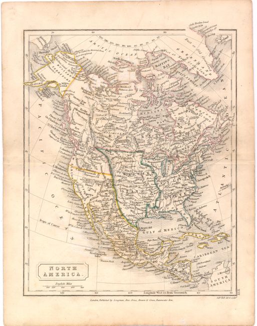
This finely engraved chart extends to include Cuba, Jamaica, St. Domingo, Greenland, Iceland, and all of Central America. The United States is confined east of the Mississippi, and the large area between the Mississippi and the Rockies is labeled Western States. Alaska is Russian Territory and Mexico occupies California and the Southwest. Much of present day Canada is labeled Rupertsland, a territory owned by the Hudson's Bay Company from 1670 to 1870, when it was sold to the newly formed Canadian Government. Rupert's Land, as it was more commonly known, consisted of the watershed of all rivers and streams flowing into Hudson Bay. The land was granted by charter to the Hudson's Bay Company by King Charles II, and was named after Prince Rupert of the Rhine, a nephew of Charles I and the first Governor of the Hudson's Bay Company. The map is filled with place names, including Indian tribes, and the watershed is well delineated.
References:
Condition: B+
Original outline color with minor foxing and a few light stains.