Catalog Archive
Auction 141, Lot 461

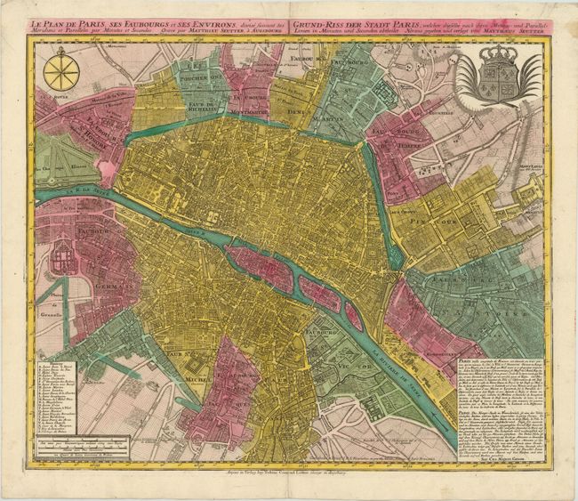
"Le Plan de Paris, ses Faubourgs et ses Environs, divise suivant ses Meridiens et Paralleles par Minutes et Secondes / Grund-Riss der Stadt Paris…", Seutter/Lotter

Subject: Paris, France

Period: 1740 (circa)

Publication:

Color: Hand Color

Size:
22.8 x 19.5 inches
57.9 x 49.5 cm
Download High Resolution Image
(or just click on image to launch the Zoom viewer)

This finely detailed plan of Paris also depicts its surrounding faubourgs and environs. A long note at lower right explains that Paris is divided into three parts, namely the City, the Town and the University. A lettered key names and locates 23 important buildings. Streets, churches, palaces, gardens, boat yards, orchards, hotels and much more are depicted on this superb plan. This fully engraved and handsome chart is further embellished with a large city coat of arms, a very nice compass rose, and three distance scales.

References:

Condition: B+

Original color with a couple of printer's creases at top and centerfold separations at top and bottom that have been closed on verso with old paper. There is a 3" tear adjacent to centerfold at bottom that has been archivally repaired.

Estimate: $1,100 - $1,400

Sold for: $800

Closed on 9/5/2012

Archived