Subject: Europe
Period: 1733 (circa)
Publication:
Color: Hand Color
Size:
23 x 19.3 inches
58.4 x 49 cm
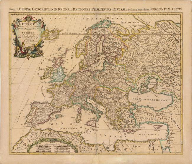
Large, attractive map of Europe, including Iceland and the Mediterranean, based on the geography of Guillaume Delisle. The German Empire dominates all of central Europe, Poland takes in all of northeastern Europe, and the Turkish Empire occupies all of southeastern Europe. Fine decorative title cartouche. Alternative title above neatline at top: "Nova Europe Descriptio in Regna & Regiones Praecipuas Divisae, ad Usum Serenissimi Burgundiae Ducis."
References:
Condition: C+
Original outline color with an archivally repaired centerfold separation that enters 4" into map at bottom. There is a small hole above the Black Sea that has also been repaired, as well as a couple of tiny unrepaired holes. There are numerous abrasions throughout England and Wales, Spain, France, and Germany, with part of image in facsimile. There are blank pen marks in bottom right corner of map.