Catalog Archive
Auction 141, Lot 306

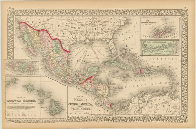
"Map of Mexico, Central America, and the West Indies", Mitchell, Samuel Augustus
Subject: Gulf of Mexico and Caribbean

Period: 1874 (dated)

Publication:

Color: Hand Color

Size:
21.7 x 13.3 inches
55.1 x 33.8 cm
Download High Resolution Image
(or just click on image to launch the Zoom viewer)

This double-page map of Mexico and the West Indies extends to include the southern states, all of the Caribbean and Bahama Islands, and a portion of northeastern South America. There is excellent detail throughout Mexico and Central America. The Baja Peninsula is here called Lower California. Four insets show the Sandwich Islands, Jamaica, Bermuda and a map of the Panama Railroad.

References:

Condition: B

Original color with a centerfold separation at bottom extending 1.75" into the image and a few minor edge tears confined to the blank margins.

Estimate: $80 - $100

Sold for: $50

Closed on 9/5/2012

Archived