Subject: Texas
Period: 1857 (circa)
Publication: A Journey through Texas
Color: Hand Color
Size:
9 x 7.3 inches
22.9 x 18.5 cm
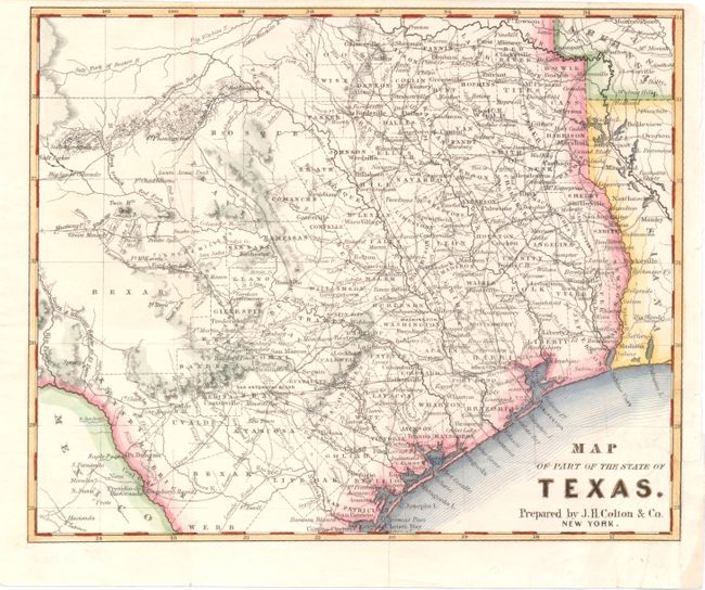
This scarce map appeared in Frederick Law Olmsted's book, "A Journey Through Texas; Saddle-Trip of the Southwestern Frontier." The map omits the Pan Handle, Big Bend and the Valley counties south of Webb County, and is one of the few pre-civil war Texas maps to show the road system, rather than railroads. Counties, county seats, and topography are also well depicted. Numerous forts are named, including Fort Martin Scott, Fort Clark, Fort Territ, Fort Inge, Fort Ewell, Fort Phantom Hill, and Fort McKavette. County lines are approximately up to date for 1857, although there is no sign of Jack county and Bexar district is already named. Other interesting features are a German settlement in Llano county, an Emigrants Route from Fort Mason to the Green Mounds, and Smith & Whiting's Route to El Paso.
References:
Condition: B+
Issued folding, now pressed with a few tiny fold separations. A binding trim at bottom right with a resulting 1/2" tear have both been archivally repaired.