Subject: New York, Eastern Canada
Period: 1849 (circa)
Publication: The Documentary History of the State of New York
Color:
Attractive lot of five maps focused on New York state along the border with Canada including:
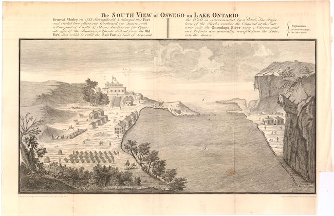
A. The South View of Oswego on Lake Ontario, black & white (14.3 x 8.8"). Shows Fort Oswego, an important frontier post for British traders in the 18th century. During the French and Indian War, this fort was captured and destroyed by the French in 1756. Condition: Issued folding with minor offsetting and one unobtrusive spot. There is a binding trim at lower right, with a 1/2" binding tear that has been closed with archival tape. (B+)
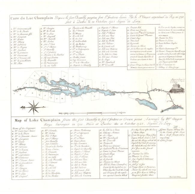
B. Map of Lake Champlain From the Fort Chambly to Fort St Frederic or Crown Point…., hand color (13.2 x 12.5"). French text at top with English text at bottom. The map shows the land grants along the river as well as the locations of forts and other important buildings. Condition: Issued folding with a tiny hole along neatline at top left. (A)
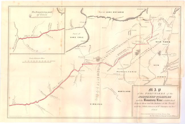
C. Map of the Frontiers of the Northern Colonies with the Boundary Line Established Between them and the Indians at the Treaty Held by S. Will Johnson at Ft. Stanwix in November 1768, hand color (17 x 11.1"). Map extends from Virginia to New York, with an inset map of the remaining part of the Ohio River. The boundary line is traced in red and follows the course of the Ohio River north to Pittsburgh, and then north to Lake Oneida. The Indians were to have the lands to the west and the settlers the lands to the east. Condition: Issued folding with light offsetting, a few minor spots, and a an archivally repaired binding tear at right that just enters map. (B+)
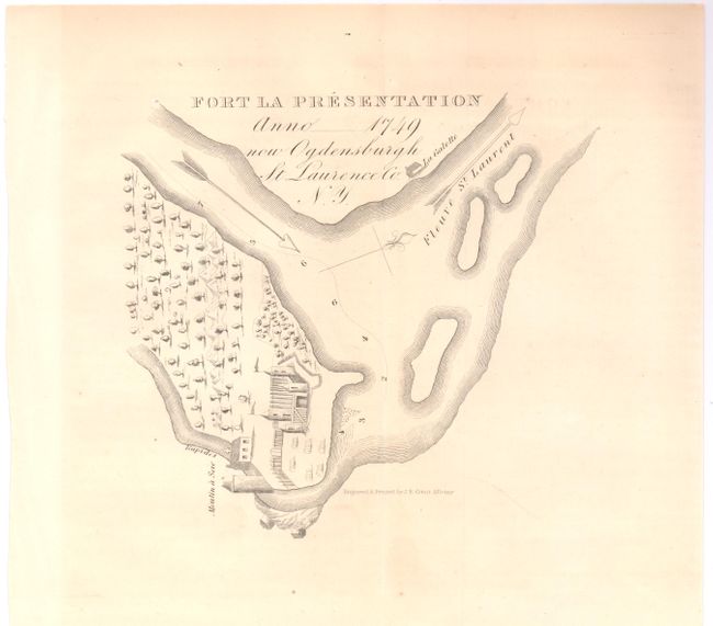
D. Fort La Presentation Anno 1749 now Ogdensburgh, black & white (6.5 x 6"). Built in 1749 by the French at the confluence of the Oswegatchie River and the St. Lawrence River in Canada. Condition: Light toning. (B+)
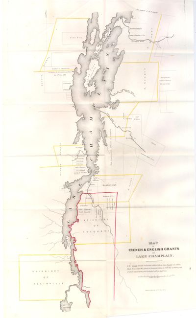
E. Map of French & English Grants on Lake Champlain, hand color (12 x 21.5"). Details the grants along both sides of the shore with landowners' names. Notation on map explains coloring: "N.B. French Grants included within yellow lines, English de. within Black lines, except the grant to Dominie Dellius in 1696, the northern part of which is laid down, and included within Red lines." Locates the Seigniory of Alainville and the Seigniory of Hocquart. Extends to show part of Lake George. Condition: Delicate outline coloring with a 2" tear at bottom that has been closed on verso with paper tape. Issued folding. (B+)
References:
Condition:
See descriptions above.