Catalog Archive
Auction 141, Lot 224

"A Map of the State of Kentucky, Drawn from the Best Authorities", Conder, Thomas
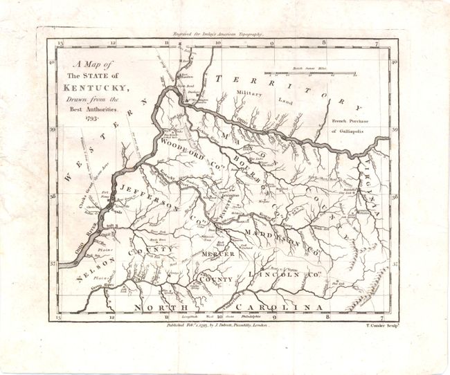
Subject: Kentucky

Period: 1793 (dated)

Publication: Imlay's American Topography

Color: Hand Color

Size:
7.5 x 6.3 inches
19.1 x 16 cm
Download High Resolution Image
(or just click on image to launch the Zoom viewer)

This scarce, early map of Kentucky shows the state just one year after achieving statehood. Only nine fledgling counties are named: Mason, Woodford, Bourbon, Jefferson, Fayette, Maddison, Nelson, Mercer and Lincoln. There is good detail of roads, forts, springs, and rivers. North of Ohio River is Western Territory, with Military Land and French Purchase of Galliopolis. Cincinnati is also shown, just three years after being named in honor of the Society of the Cincinnati.

References:

Condition: B+

Issued folding, now flattened, with a few minute spots and a bit of roughness in the paper at left, just entering the map border.

Estimate: $475 - $600

Sold for: $350

Closed on 9/5/2012

Archived