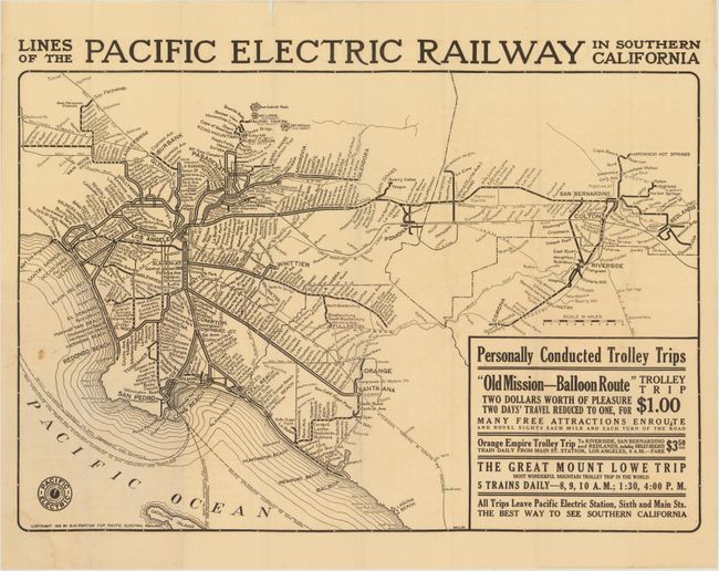
Subject: California
Period: 1912 (dated)
Publication:
Color: Black & White
Size:
22.8 x 16.5 inches
57.9 x 41.9 cm
This transit map shows the evolving network of the Pacific Electric Railway in the early 20th century. The main rail line connected the cities of Los Angeles and San Bernardino, with spoke lines going to the coastal cities, the San Fernando Valley and the Inland Empire. By 1925, the Pacific Railway was the largest in the world, consisting of streetcars, light rail and buses. Drawn by D.W. Pontius.
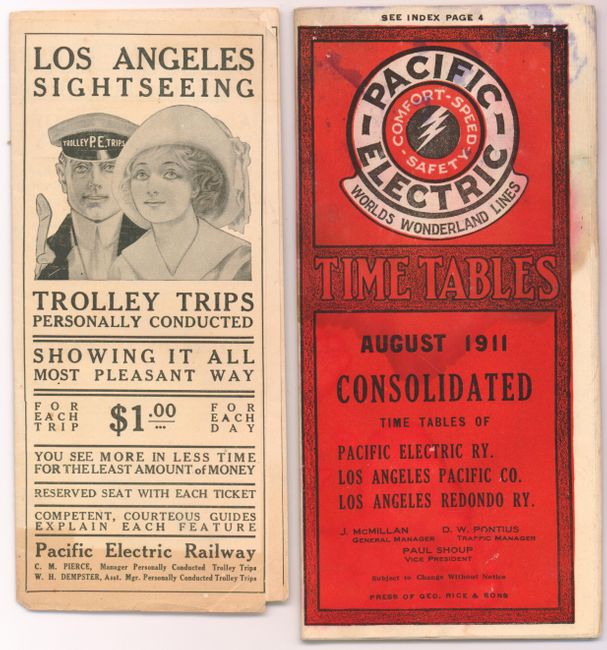
Included with the transit map is a 48 pp. brochure (4 x 8.5") of time tables filled with numerous advertisements and a promotional brochure for trolley trips in Southern California (3.3 x 8"), "showing it all...most pleasant way." Offerings include the "Orange Belt Special", the "World Famous Mountain Trolley Trip" to Mt.. Lowe and the "Seeing Los Angeles Observation Car."
References:
Condition: B
Issued folding with a few tiny splits at fold intersections, a couple of small spots in the image, one edge tear confined to the blank margin, and a hint of toning. The time tables brochure is damp stained and the trolley brochure is lightly toned.