Subject: California
Period: 1855-56 (dated)
Publication:
Color:
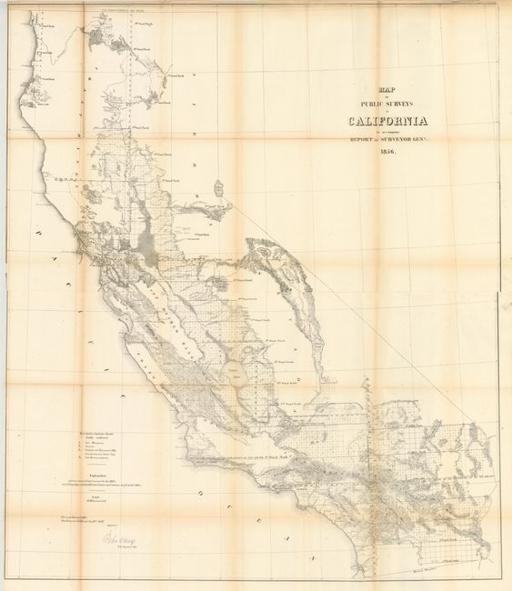
A. Map of Public Surveys in California to Accompany Report of Surveyor Genl. 1856, by U.S. State Surveys, dated 1856, black & white (36 x 30"). This large and remarkably detailed map delineates the progress of public surveys throughout the state on the scale of 18 miles per inch. About one-third of the state, in the north and east, remains unsurveyed. Lake Tahoe is shown fairly accurately, but is still called Bigler Lake. Printed on two sheets, joined as issued. Condition: There are a few short splits at fold intersections, light scattered foxing, and faint toning along the folds. There are a few edge tears closed on verso with archival tape, several of which just enter map border. Narrow left margin. (B)
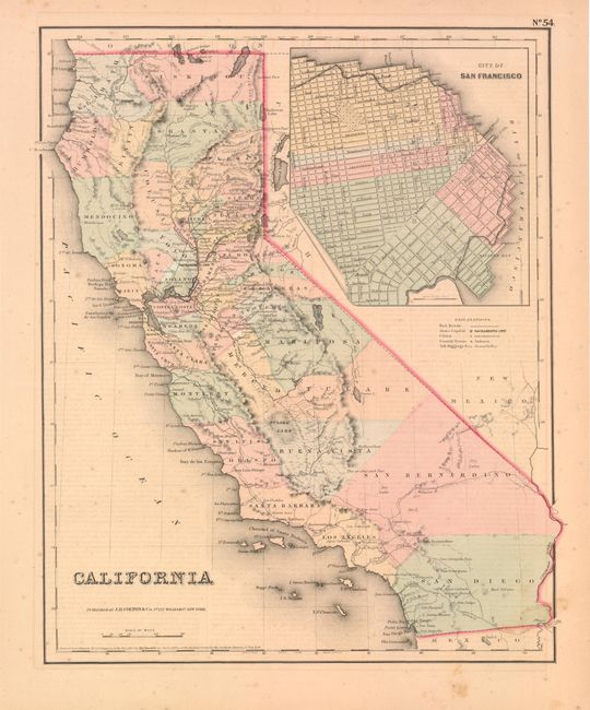
B. California, by Joseph Hutchins Colton, from Atlas of the World, dated 1855, hand colored (11.8 x 14.7"). This is one of the best mid-nineteenth century atlas maps of California. It shows the entire state with Utah and New Mexico territories on the eastern border. Two proposed railroad routes through the Central Valley are labeled "Explored Route for Atlantic & Pacific R.R." and a northern route through Fredonyers Pass, north of Pyramid Lake, is marked "Practicable Route for Atlantic & Pacific R.R." The only completed railroads service the Gold Regions and Sacramento. A huge inset titled "City of San Francisco" shows the planned land expansion into the bay with the streets already drawn in. Condition: Light scattered foxing and faint toning. (B+)
References:
Condition:
See description above.