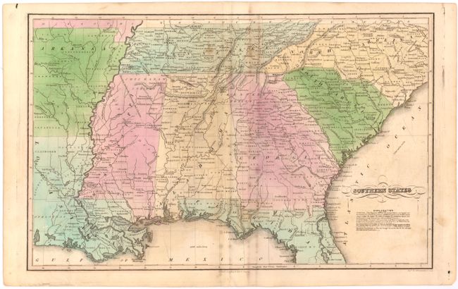
Subject: Southern United States
Period: 1867 (circa)
Publication:
Color: Hand Color
Size:
16.8 x 10.6 inches
42.7 x 26.9 cm
Map of the southern United States covering the area from North Carolina south to Florida and west to Louisiana and Arkansas. An unusual feature of this map is that town population is noted in relative size to Hartford, Connecticut which had approximately 10,000 people at the time the map was issued. A symbol of "1/4" indicates 2,500 inhabitants, "1/2" implies 5,000, etc. County development in South Carolina suggests a circa date of 1867 as Oconee County had not yet been created from Pickens in the northwestern portion of the state.
References:
Condition: B
Minor offsetting with light foxing and staining.