Subject: United States
Period: 1872 (published)
Publication:
Color: Printed Color
Size:
9.5 x 12 inches
24.1 x 30.5 cm
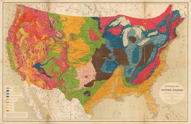
This large and very colorful thematic map is included with the Ninth Census report published in 1874. It identifies railroads, roads, canals, army arsenals, forts and much more. A table at lower left provides an explanatory key to the colors used to indicate nine distinct geological formations. The carefully drawn map shows good geographical detail as well as the remarkable geological information. The geography of the map is from the War Department's "Military Map of the United States," used by permission of the Chief of Engineers.
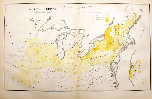
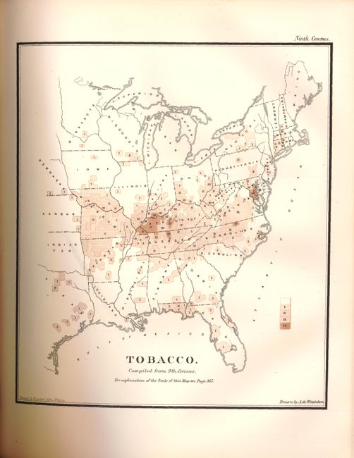
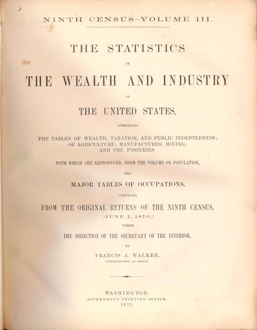
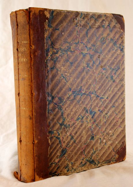
The map is accompanied by the original 843 pp. book on the Ninth Census report, Volume III by Frances A. Walker, which is filled with statistics and a number of thematic maps focused on manufacturing and agriculture. In his report Walker used the relatively new field of thematic cartography to illustrate certain population statistics from the census by means of varying intensity of color on maps - a novel technique at the time. Hardbound, half-calf with marbled boards.
References: Marcou & Marcou #70; Phillips (A) 1330.
Condition: B+
There are two 3" fold separations that have been repaired on verso with archival tape along with some light soiling on a few folds. The covers are worn, the edges are bumped and the hinge is starting.