Subject: Southern Africa
Period: 1596 (circa)
Publication: Itinerario…
Color: Hand Color
Size:
21 x 15.5 inches
53.3 x 39.4 cm
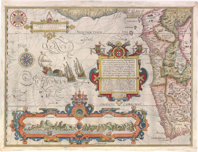
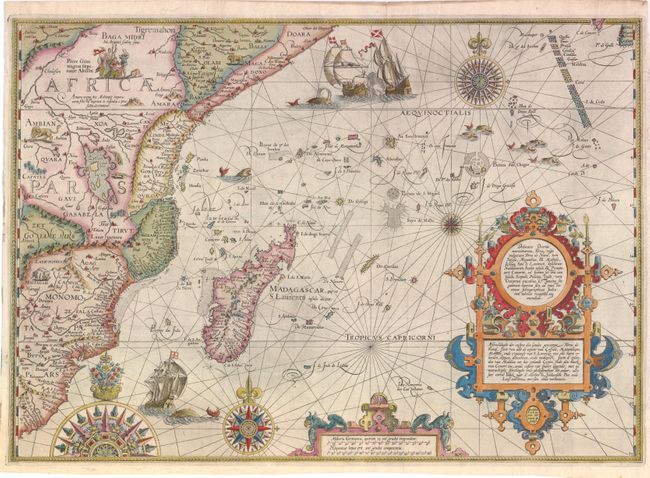
This matched pair of maps of the western and eastern coasts of Africa are two of the most richly ornamented maps in early cartography, superbly engraved in the Flemish style by Arnold Florent van Langren. The cartouches contain descriptions of the region in both Latin and Dutch that credit the source as "the very best Indian maps" - referring to maps that Linschoten had access to when he was Secretary to the Portuguese Archbishop of Goa in India.
The western map covers the southwestern coast of Africa from the Gulf of Guinea to just beyond the Cape of Good Hope with excellent detail along the coastline. The fictitious cities of Vigiti Magna and Monomotapa are located and most place names and geographical features have Portuguese nomenclature. The mainland is embellished with snakes, an elephant, a rhinoceros, a lion and a pair of sirens in Lake Zaire. The balance of the sheet is filled with fabulous cartouches, the Portuguese arms, elaborate compass roses, sailing ships and a sea monster. The large bottom cartouche encloses views of Ascension and St. Helena Islands; important refueling ports in the route around Africa.
The eastern map extends from R. do Infante to Doara, and includes Madagascar and the tip of the island of Ceylon. Typical geographical features of the time are shown, such as the Lunae Montes (Mountains of the Moon), and Zaflan Lacus depicted as one of the sources of the Nile River. The extensive coastal details are likely sourced from Portuguese portolan charts, especially those of Bartolomeu Lasso. The map is richly adorned with the Christian emperor Prestor John, elephants, and lions inhabiting Africa, as well as ships, sea monsters and elegant compass roses filling the Indian Ocean.
References: Norwich #239a & #239b; Tooley (MCC-29) #167 & #168; Tooley et al [Landmarks] pp. 168-69.
Condition: B+
Issued folding on watermarked paper with expert repairs to several fold separations and a couple of minute worm holes. On the western map there are 1" and 2.5" tears at left that have been professionally repaired. On the eastern map there is a 1" tear at left that has also been skillfully repaired.