Catalog Archive
Auction 140, Lot 754

"A Chart of the Islands to the Southward of Tchu-San on the Eastern Coast of China Generally Laid Down from One Published by Alexander Dalrymple Esqre. with Additions and Alterations", Barrow, John (Sir)
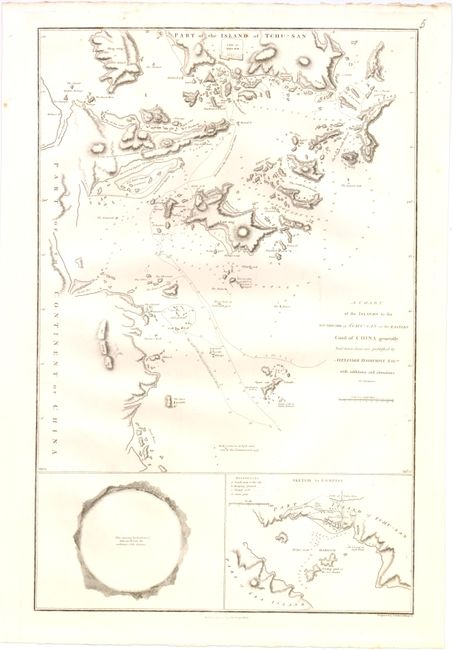
Subject: China

Period: 1796 (dated)

Publication: An Authentic Account of an Embassy from the King of Great Britain…

Color: Black & White

Size:
13.8 x 21 inches
35.1 x 53.3 cm
Download High Resolution Image
(or just click on image to launch the Zoom viewer)

This large chart was part of an account of George Macartney's travels to China. Maccartney was Britain's first envoy to China, and was tasked with convincing emperor Emperor Qianlong to ease restrictions on trade between Great Britain and China by allowing the British to have a permanent embassy in the country.

This finely executed chart of Zhoushan Harbor, located just south of Shanghai, presents a significant amount of detail with soundings, anchorages and extensive notations. At bottom is a plan of the City of Ting-Hai and vicinity and a unique circular panoramic view from an anchorage in the harbor. Drawn by John Barrow, who was the private secretary to Lord Macartney. He was later Secretary to the Admiralty and was a vice-president and founding member of the Royal Geographical Society. Published in London by George Nicol.

References:

Condition: A

Nice impression with a few minor spots, else fine.

Estimate: $200 - $240

Sold for: $100

Closed on 5/23/2012

Archived