Subject: Northern Asia
Period: 1635-83 (circa)
Publication:
Color: Hand Color
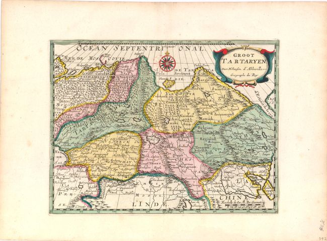
A. Groot Tartaryen, by Nicholas Sanson, from Geographise en Historise Werelt Beschryving, circa 1683 (9.8" x 7.5"). Attractive map of Siberia, northern China, and Korea, which is shown here as an island. The cities, mountains, forests and rivers are well-detailed. Siberia still reflects some of Ptolemy’s conceptions with the Island of Tazata and the Cape of Tabin in the extreme north. The map is decorated with a lovely title cartouche as well as a beautiful compass rose. Engraved by Antoine d'Winter for a Dutch edition of Sanson's small atlas. Ref: Pastoureau, Sanson III F. Condition: Old color with gilt highlights and wide margins with minor color offsetting and tiny abrasions adjacent to compass rose.
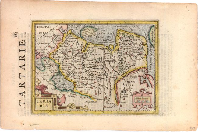
B. Tartaria, by Mercator/Hondius, from Historia Mundi, circa 1635 (7.5" x 5.5"). Charming small map of the northern region of Asia fully engraved with mountains, forests, and towns. It includes part of China and the island form of Korea. The Anian Fretium separates Asia from Americae Pars, the Pacific Northwest of America. The map is adorned with decorative strapwork title and scale of miles cartouches. English text on verso. Condition: Lovely color with light toning along sheet edges.
References:
Condition: A
See description above.