Subject: Sicily, Italy
Period: 1721 (published)
Publication: New General Atlas
Color: Hand Color
Size:
22 x 19 inches
55.9 x 48.3 cm
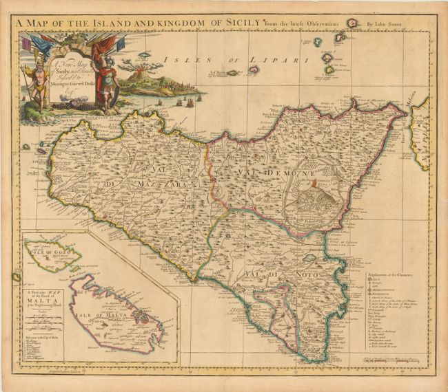
This decorative map of Sicily shows the three provinces and the county of Modica. A legend at bottom identifies cities of various sizes, archbishoprics and bishoprics, abbeys, fountains (artesian wells), anchorages, ruins, and even navigational hazards along the coastline. An inset map depicts the islands of Malta and Gozo, with a miniature bird's-eye view of the fortifications of Valletta and nine locations identified within the city. Particular attention is paid to Mount Etna, which is shown erupting both on the map and in a vignette adjacent to a cartouche dedicated to Montague Garrard Drake Esquire, a member of British parliament between 1713 and 1728. The dedication cartouche is also flanked by Neptune and a Roman warrior.
References: Shirley (BL Atlases) T.SEN-2a #18.
Condition: B
Watermarked paper with a few minor spots and two short cracks near the centerfold caused by the oxidation of the original blue pigment. There are short edge tears that have been closed with archival materials.