Subject: Balkans
Period: 1680 (circa)
Publication:
Color: Black & White
Size:
19.4 x 15 inches
49.3 x 38.1 cm
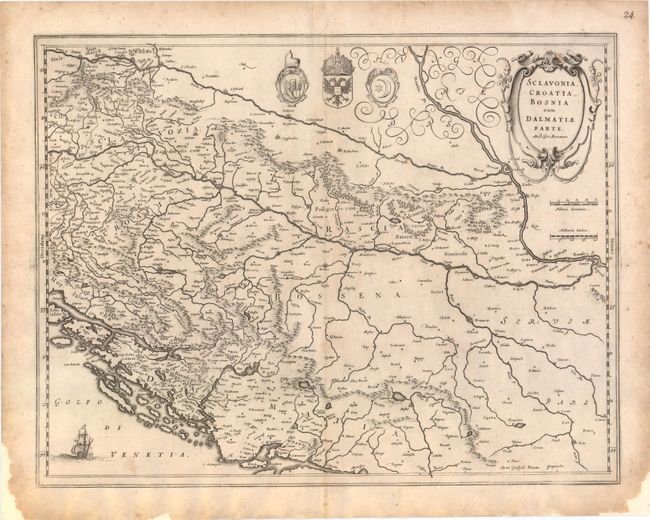
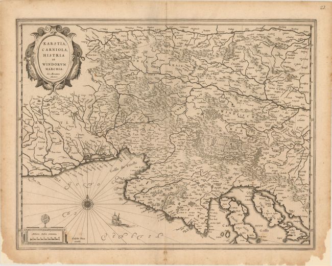
Two detailed maps of the Balkans, each of which includes a strapwork title cartouche that credits the map to Gerard Mercator. There is no text on back of either map, indicating they were issued after the demise of the great Blaeu publishing empire, as these were among the plates auctioned in 1677 following the fire that destroyed the printing house.
A. Sclavonia, Croatia, Bosnia cum Dalmatiae Parte. The course of the Danube and its tributaries across the northwestern Balkans is the focus of this handsome map. It shows the political divisions of Slovenia, Croatia, Bosnia, Serbia and Dalmatia and locates even the tiniest hamlets. The coats of arms of the Venetian Republic, Habsburg Monarchy, and Ottoman Empire reflect the power struggle that dominated this region.
B. Karstia, Carniola, Histria et Windorum Marchia. A fine map of the northern tip of the Adriatic Sea and the Gulf of Venice, present-day northeastern Italy, Slovenia and Croatia. Decorated with a title cartouche, compass rose, distance scale cartouche and a sailing ship.
References:
Condition: B+
Both have a few faint spots with light foxing and paper has been added in blank margins to repair several chips. Backed with Japanese tissue.